
Parametric data
- Route name:
- Petersfield
- Start point:
- Havant.
- End point:
- Petersfield.
- This route on OS maps:
- https://explore.osmaps.com/route/18771062/...
- Distance:
- 12.9 miles walked, 10 miles flown.
- 4.9 hours.[1]
- Ascent:
- 281 metres.
- Stiles:
- 4.
- Landmark of note:
- St Hubert's Chappel.
- Feasible excursion:
- The Staunton Way is an obvious alternative as far as the QECP. It is a surprise that the OS app was uninterested.
- Waypoints:
- Rowlands Castle, Finchdean, Idsworth, Woodcroft Crossing, Chalton, Buriton.
- Refreshments:
- Coffee skipped due to late start. Packed lunch at the Buriton Chalk Pits.
-
Weather: -
 14°C,[2] 🌥️ A
late autumn this year, so only a stiff breeze inhibits my
progress.
14°C,[2] 🌥️ A
late autumn this year, so only a stiff breeze inhibits my
progress.
-
Avoiding roads: -
 Mile after mile of minor roads without footway.
-
Footpath construction: -
Lots of tarmac, but Head Down is dirt.
-
Footpath condition: -
Dry on the day, except 1) at the Chalk Pits and 2) just
after B2070. No real problem.
-
Vistas: -
 Woodcroft Crossing is about it.
Blackberries:-
Past their best now, but brambles a-plenty.[3]
Route map.
Walk notes.
He shaved his head, grew a tremendous beard, and accustomed himself to oriental dress.[4] Thus disguised, he hoped to pass as a traveling healer, which seemed a promising way of working his passage from village to village.
Story Time, BBC Home Service, Tue 9th Aug 1966.
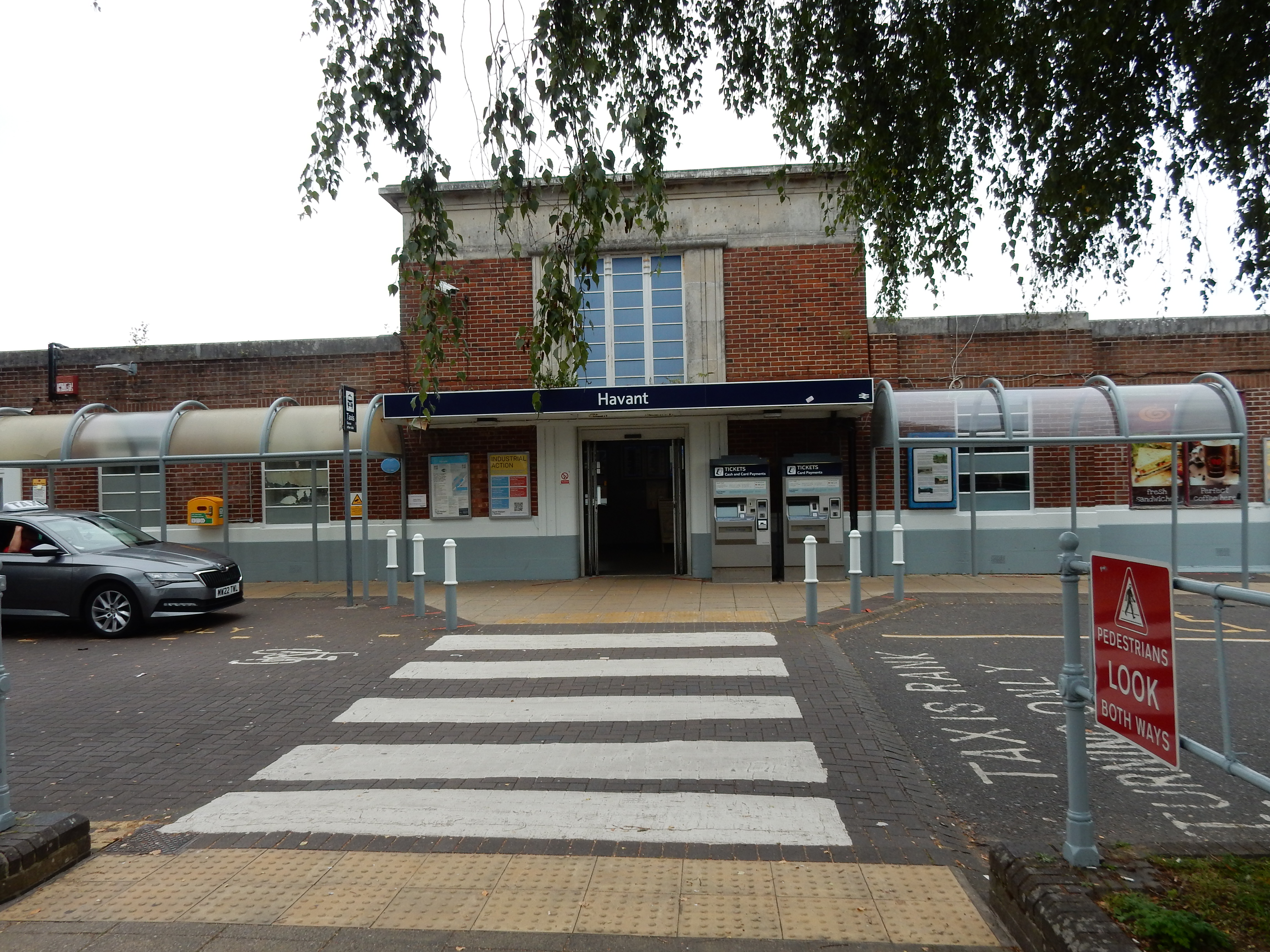
My previous walks havant started from here, so great excitement attends the commencement today 🤥 Sadly, the thrill does not last beyond a hundred yards from the station as it dawns on me that I have taken the southern exit. Construction work in the vicinity soon forces my arrival at the Elmleigh Road Roundabout (which wasn't quite the plan). This disaster fails to ruin my entire day, but it won't be the only navigational blunder to affect proceedings. The whole morning has gone before I approach the limits of suburban Havant, as this resident cares to inform me.
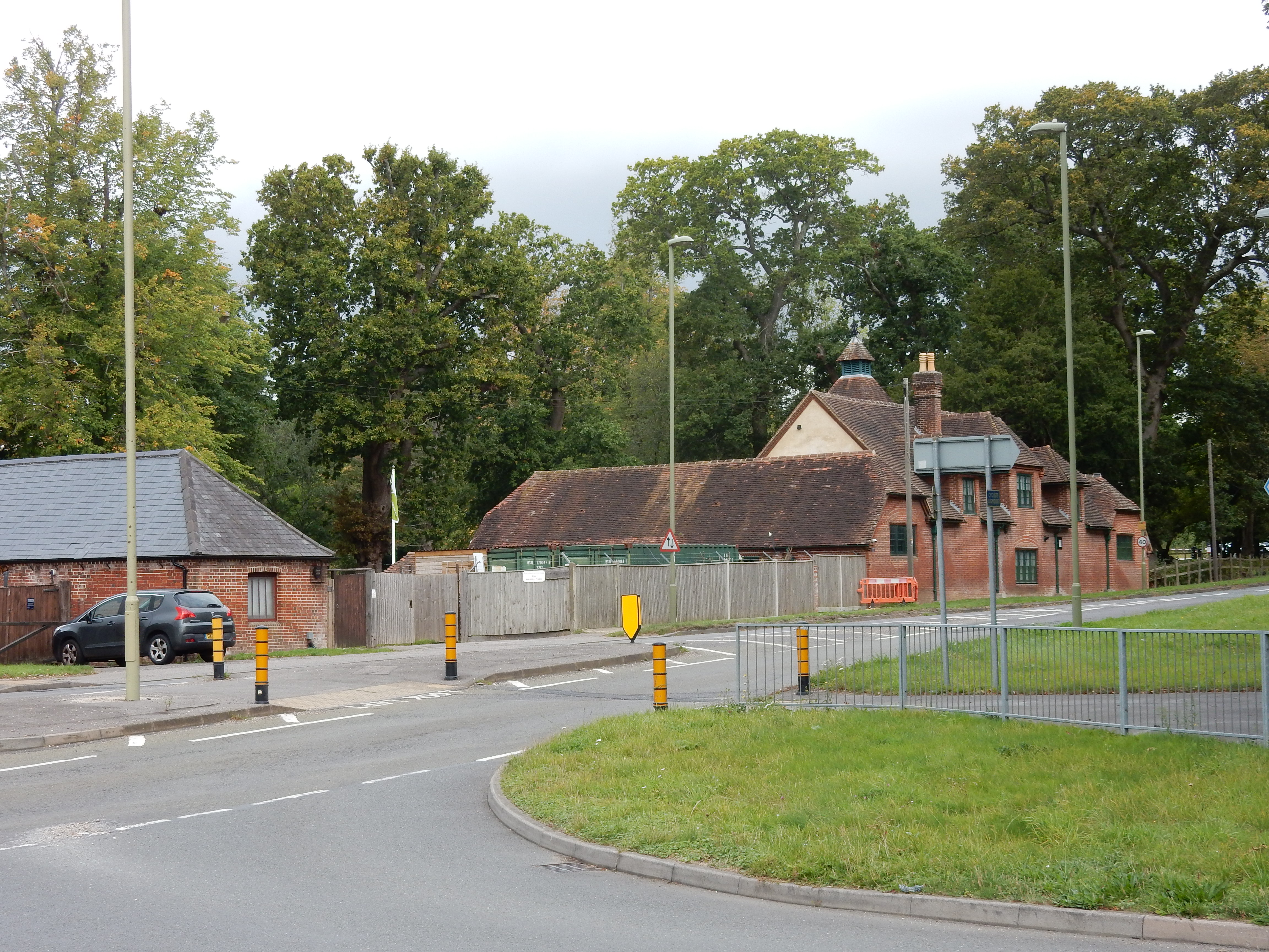
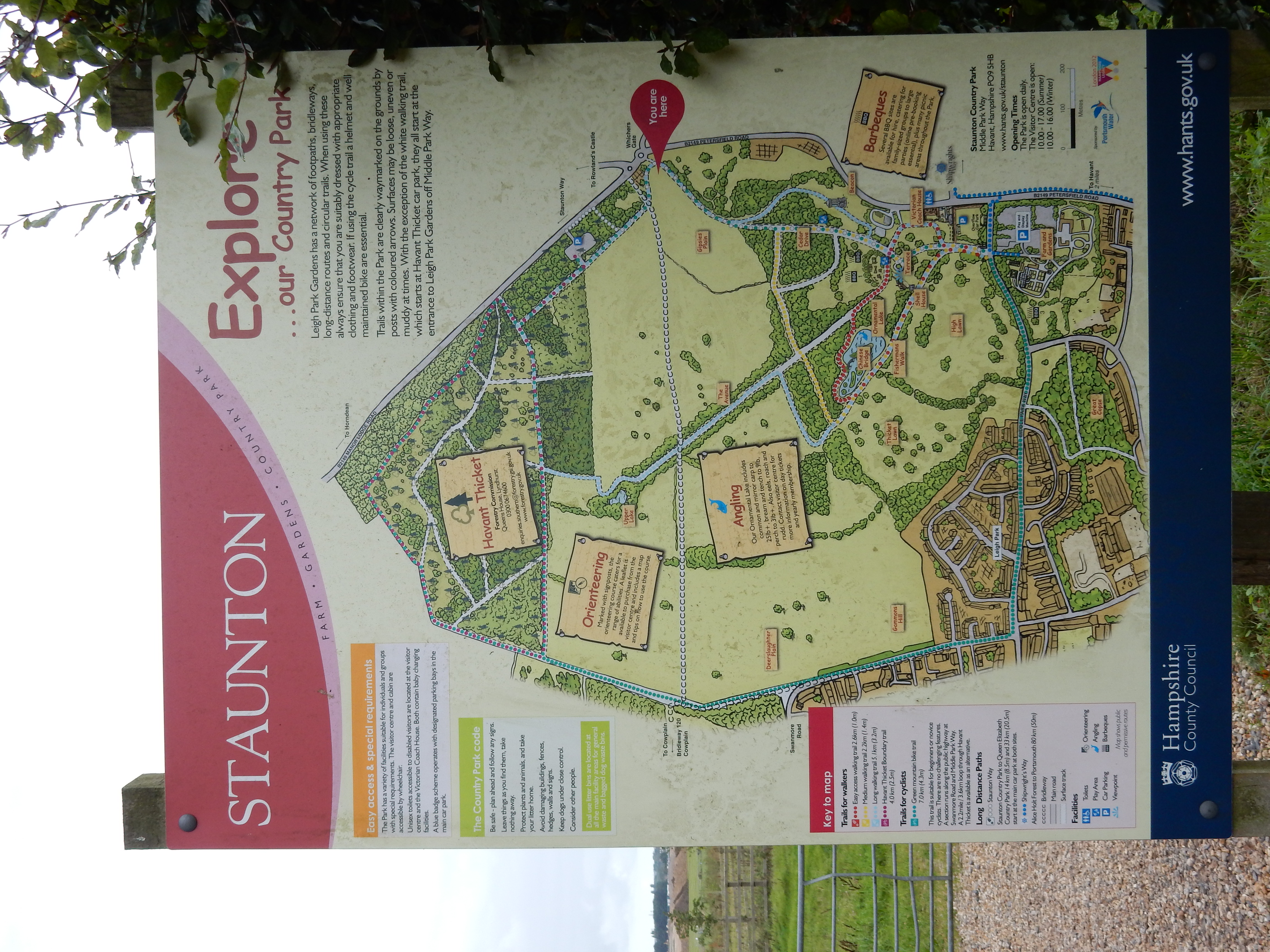
At the most northerly point on this stretch is the Staunton Country Park. This particular venue has been on my radar for the last year. The eponymous owner of this chunk of Hampshire, Sir George Thomas Staunton, is vividly portrayed by his biographer, sinologist Henrietta Harrison in her recent publication The Perils of Interpreting. The peril Staunton encountered was that an ill advised choice of words could be the last mistake you made as a translator from English to Chinese.[5] In the 1820s the Park was visited by Britain's first sinologist: Thomas Manning.[6] Manning is said to have pulled his own beard out, by the roots, and is described to me by an authoratative Oxford scholar as "Quite mad." I hope that no genetic cause of Manning's affliction was shared with other members of his family because, by curious coincidence, Manning, Professor Harrison and today's rambler through the Park share ancestors in common.[7]
Well, through the Park isn't quite right because, mindful that remaining daylight is in short supply, and that more than ten miles remain to go, I decide to save a wander around inside for another day. The next ¾ mile of B2149 is much less interesting, but it gets me to the back entrance to the Park, and Rowlands Castle, rather faster than Plan A.[8] The OS makes a meal of its transition of Rowlands Castle. It likely thought I would prefer the Golf Course to Suburbia 🙄 I will take a shorter, less convoluted route on any repeat of this walk. Between here and Finchdean is, however, Hobson's Choice: ploughed field; and lots of it. After the rail line ignore the footpath sign to your right. Stay in what the OS is pleased to call Shipwrights Way for a further two miles. Technically, this is an 'in-road' walk with high hedges and no verge, but the traffic is so light that you may suffer no permanent traumatisation.[9] The In the South Downs National Park do not be alarmed if you detect birdsong; this is perfectly natural. Ongoing efforts to eradicate it need more time to complete. As you begin to think that you are in the middle of nowhere, into view comes Idsworth and St Huberts Chapel.
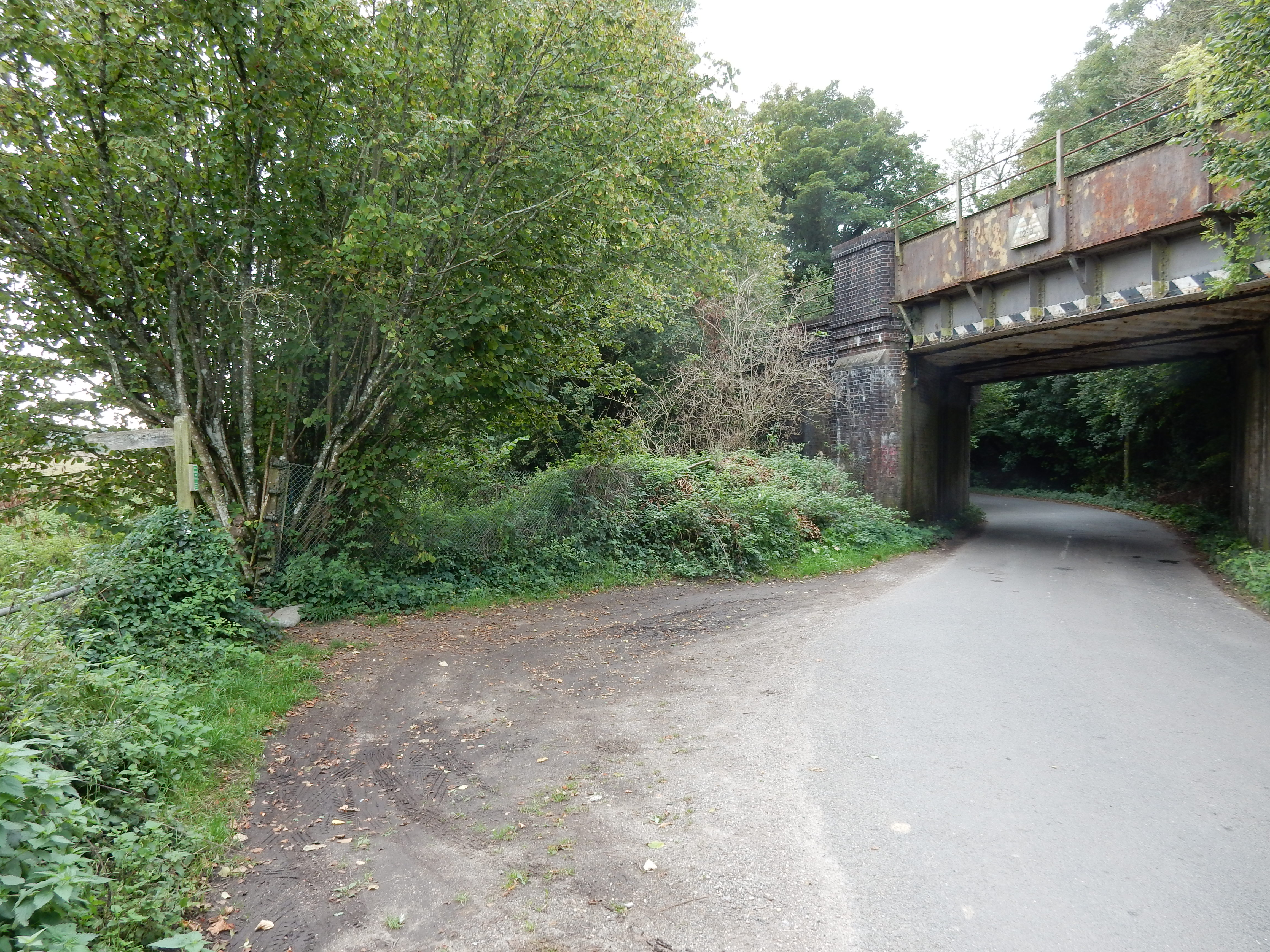
Shipwrights Way becomes progressively even narrower at Woodcroft Farm where it hops over the Portsmouth to Woking line by this footbridge. This is 70 metres ASL, the ascent from the coast having been fairly steady, and the autumn gusts are audible. I continue the climb for the next two miles, almost to 200 metres ASL. New Barn Lane, although a public road, is hardly a feeder for the M3, and the walk in it leaves all nerves unjangled. As the rail line continues north along the valley, the OS route diverges to the west as it climbs up towards Head Down. The first part of this goes along a treeless, exposed ridge at 130 metres ASL. The path was a bit indistinct in places, but you are basically going under the power line shortly before the summit and Head Down. I mean you head up, not head down. Honestly, it's not really confusing.
By the top of Head Down I'm bone-weary. Am I supplied with a seat to recover on for five minutes? Has the spot been cleared of trees blocking an otherwise fine view? Harumph, mutter, mutter 🥵 Compensation arrives ten minutes later at the Chalk Pits Local Nature Trail. You get a seat, protection from the wind, a small pond by which to consume your packed lunch, artworks to look at, and a couple of info boards to read meanwhile. I would be more effusive about the Chalk, had I not forgot that it could be highly slippery when at all wet. Attempts to clean myself up are partially successful. The notice claims that horses carting the chalk around were 'rewarded' with a bath in the pond.[10]
 (Photo scanned from a contact print.)
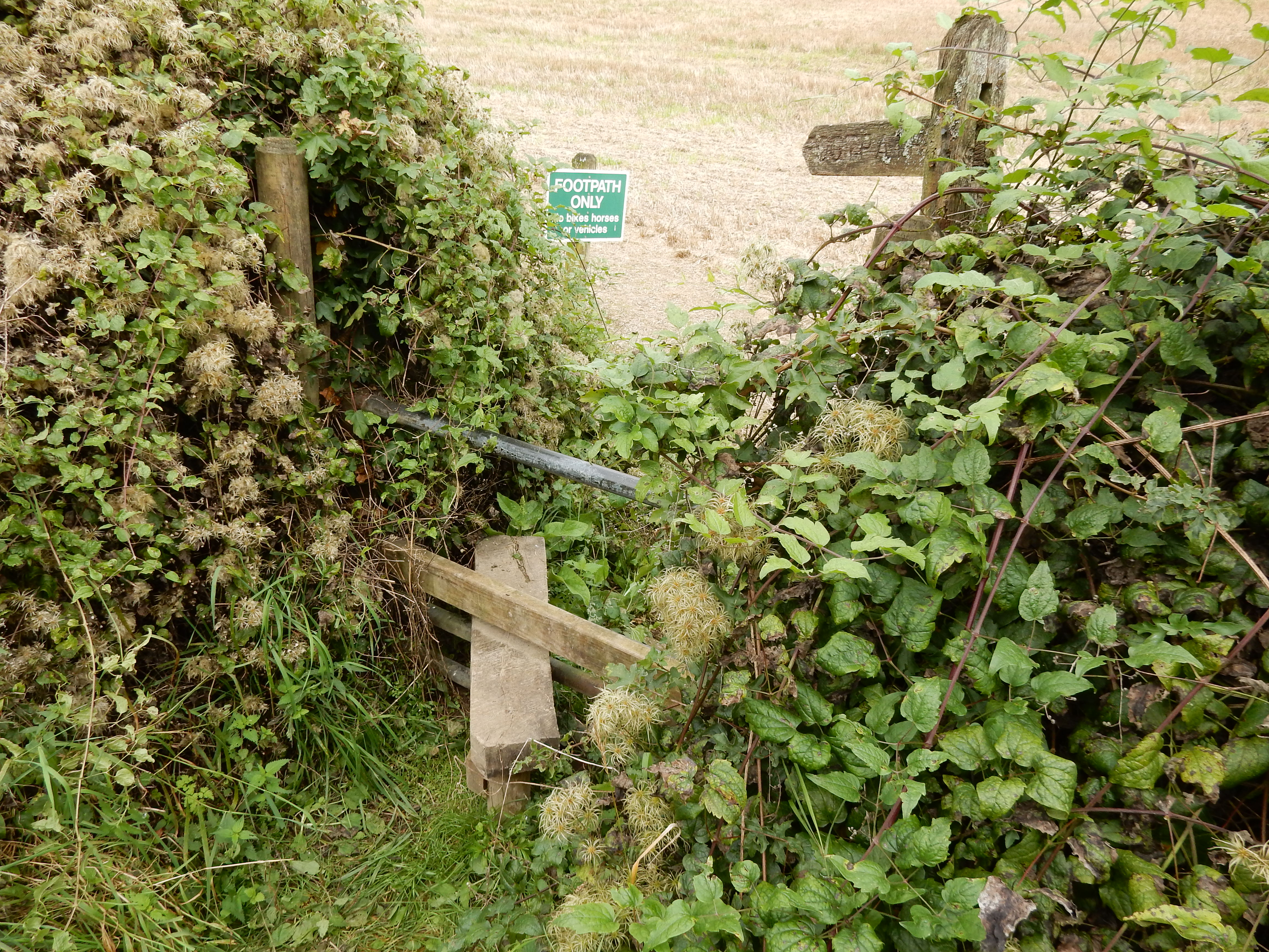
I leave Buriton for Bolinge Hill on the grandly titled Petersfield Road. This, too, might be considered inadequate for a residential driveway, but is OK for walking and, indeed, is still officially Shipwrights Way. North of the Hill and the B2070 the news isn't so good. The going here is soggy, and the route is neglected, overgrown and indistinct. I'm forced to deploy secateurs to get through. All four of the stiles on this walk are found on this stretch - and one of them was broken. Still keeping a close eye on the GPS, I weave through residential southern Petersfield and then hop across the rail line for the final time. I find there ¼ mile of Screwfix and similar retail / light industrial premises.
Although this is my first visit to Petersfield, the area was well known to my father, Gregory. As a boy, at the beginning of WW2, he was 'evacuated' from London to a nearby farm. He recounted the times when he was taken to Butser Hill to shoot rabbits: a task for which life in Norbury had not prepared him. The caption appears to be in his father's hand.
Nearing central Petersfield, I drop in on a former colleague, now also retired, for a cuppa, a natter and to rest my weary everything used during the previous thirteen miles. It's well after sunset before I reach the station but, happily, the rush hour train has a seat free. All in all, a satisfying walk, supplying inspiration for others along the South Downs. Thinks: Petersfield to New Alresford?