

Parametric data
- Route name:
- LowerStreet
- Start point:
- Lower Street.
- End point:
- Sheringham.
- This route on OS maps:
- https://explore.osmaps.com/route/19179082/ ...
- Distance:
- 11.1 miles walked, 7.8 miles flown.
- :
- 4.4 hours.[1]
- Ascent:
- 210 metres.
- Stiles:
- 0 (zero).
- Landmark of note:
- Cromer Air Traffic Radar.
- Feasible excursion:
- TBA
- Waypoints:
- Frogshall, Overstrand, Cromer, East Runton, West Runton, Beeston.
- Refreshments:
- Nowhere for coffee. BLT from Sainsburys, but should have done lunch at - The Rocket. Plenty of places to eat in Cromer.
Weather:-
 8°C,[2] ☁️
Early drizzle. Not warm.
8°C,[2] ☁️
Early drizzle. Not warm.
-
Avoiding roads: -
 Over a mile of Craft Lane. Three cyclists passed me, but no
vehicles.
Over a mile of Craft Lane. Three cyclists passed me, but no
vehicles.
-
Footpath construction: -
 The stretch up to Overstrand is mostly dirt.
-
Footpath condition: -
Parts walkable only in wellies. Recent heavy rain.
-
Vistas: -
 Beeston Bump is on the OS as a viewpoint. It's a point of
view.
Beeston Bump is on the OS as a viewpoint. It's a point of
view.
Blackberries:-
Along the stretch up to Overstrand.[3]
Route map.
Walk notes.
The past is a foreign country. They do things differently there.
Weather forecasts; what do you make of them? Today's is for zero percent chance of rain in Norwich. Great, methinks. I've been staring out the window for the previous nine days, looking at leaden skies half the time and actual downpour the other. I have only another three day's stay in the county, and will feel robbed if I can't fit in a single walk. So Mr. Meteorology gives me all the encouragement I need to go for it now. Except that there is also a 'weather warning' of heavy rain for all of England. As I board my train, 'zero percent' impacts my cranium directly - because I left my cap behind. Sigh.
Attire at the opposite end of your scribe also troubles him. The inner lining of my right foot's boot has a stitched seam protruding into my ankle. Attempts to patch it fail, so I end the walk with a cut there. Ow 😫
This being my first journey on the Bittern Line, I am taken by surprise when the train reverses out of Cromer the same way it pulls in. So it goes. Gunton Station is not exactly Liverpool Street yet, as usual, I am momentarily uncertain whether I have left by the correct exit. Doubt is unwarranted. The Bittern is single track working. Gunton has a single platform with one way out only. As Doctor Samuel Johnson did not quite put it, the wonder is not that it has trains on just one platform, but that it has trains at all. How did it survive fall of The Axe in the sixties? Hartley wrote of further south in Norfolk, but Gunton used a northbound platform in 1876.
What? You don't want to hear any more about trains? Look, Norfolk doesn't do impatience. I came here on holiday for a break from you and your London ways. If the walk takes four hours then you can wait that, too. For five hundred years my ancestors managed in Norfolk without FTTH, so keep your wig on. The Suffield Arms, in splendid isolation, has a history involving the railway but, since you're not in a mood to listen, I shall say no more.
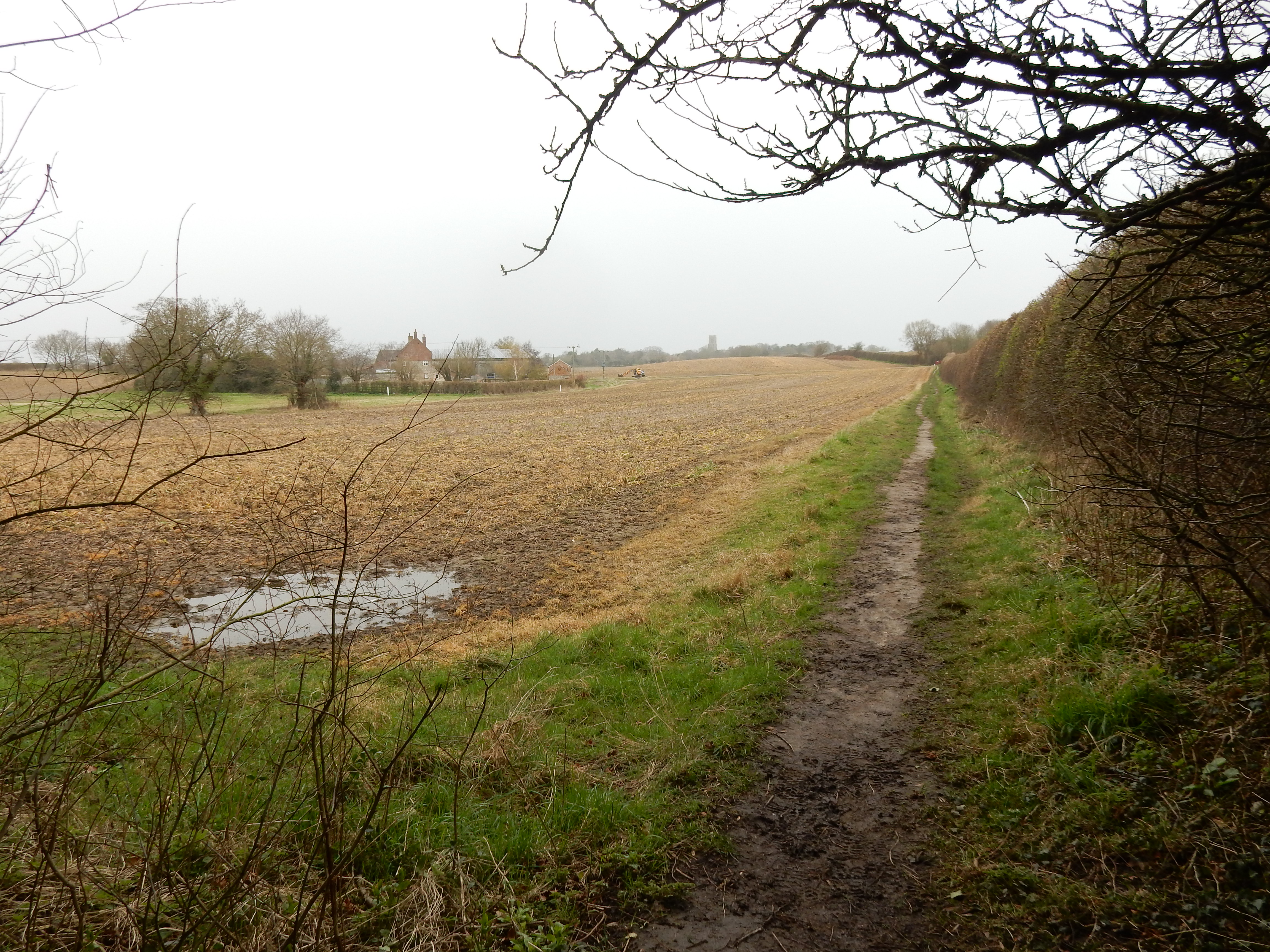
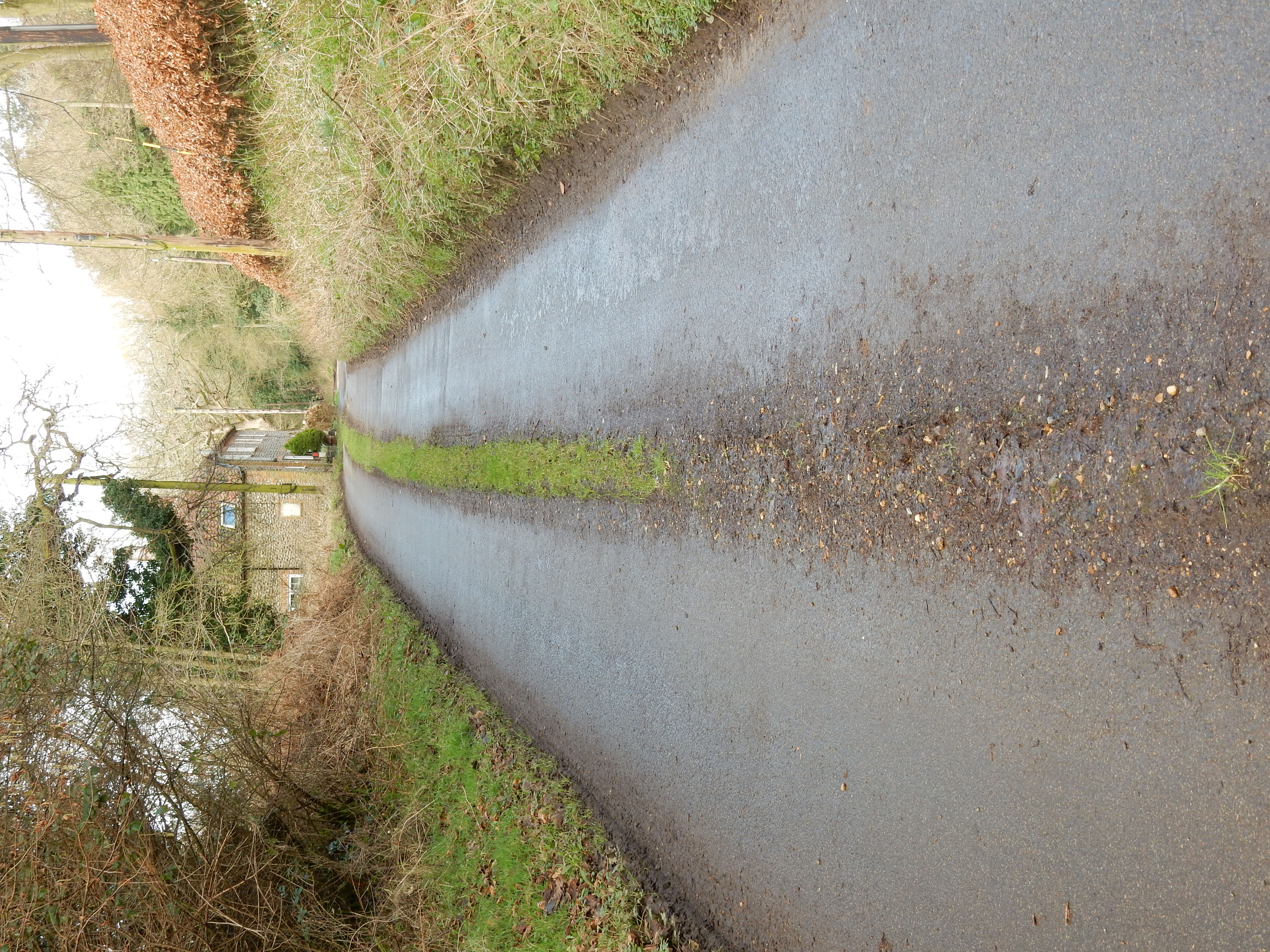
Between Lower Street and Southrepps there is ⅔ mile of typical Norfolk open field and big sky; all filled with water, of course 🙄 Southrepps, too, has a sizeable PH,[4] but it isn't open yet. From here to Frogshall is all tarmac along Craft Lane. Without traffic this is the walk's easiest going. I say tarmac, but this much grass growing on it is confirmation that I'm on the right road. Watch out for the right turn, opposite the house, that leads upwards through Frogshall Wood. With increasing levels of gyp from my right foot, I fail to lift it properly, and begin tripping over tree roots. Wonderful.
A couple of minutes after the wood I pass a tree to the right that has a notice pinned to it: The Legend Of Esmerelda & The Shrieking Pit. Not that any could possibly doubt the veracity of this narrative, for right behind it is the pit in question. I would post a video (featuring forementioned wailing noises on its audio track), but this blog must remain family rated.
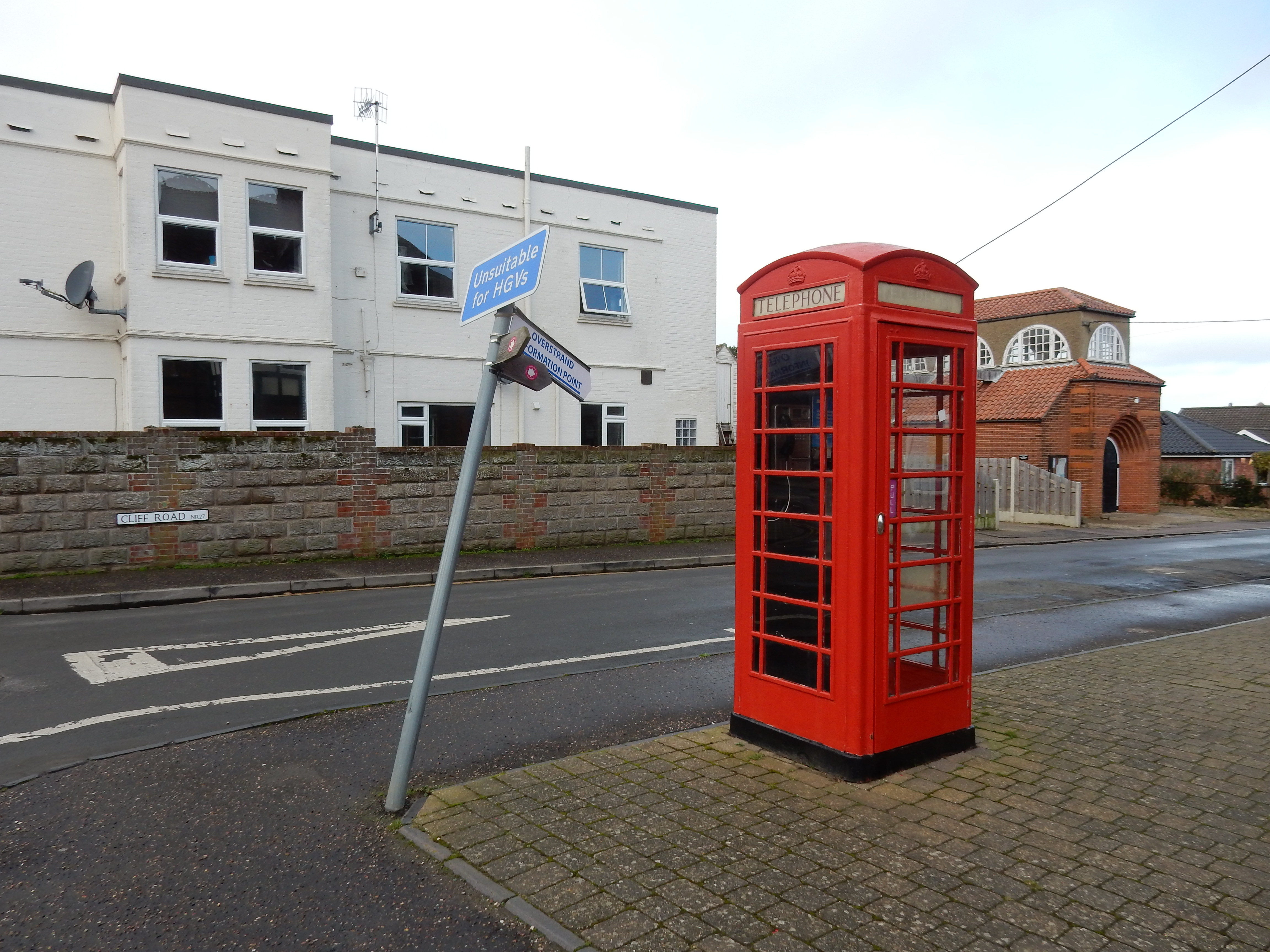
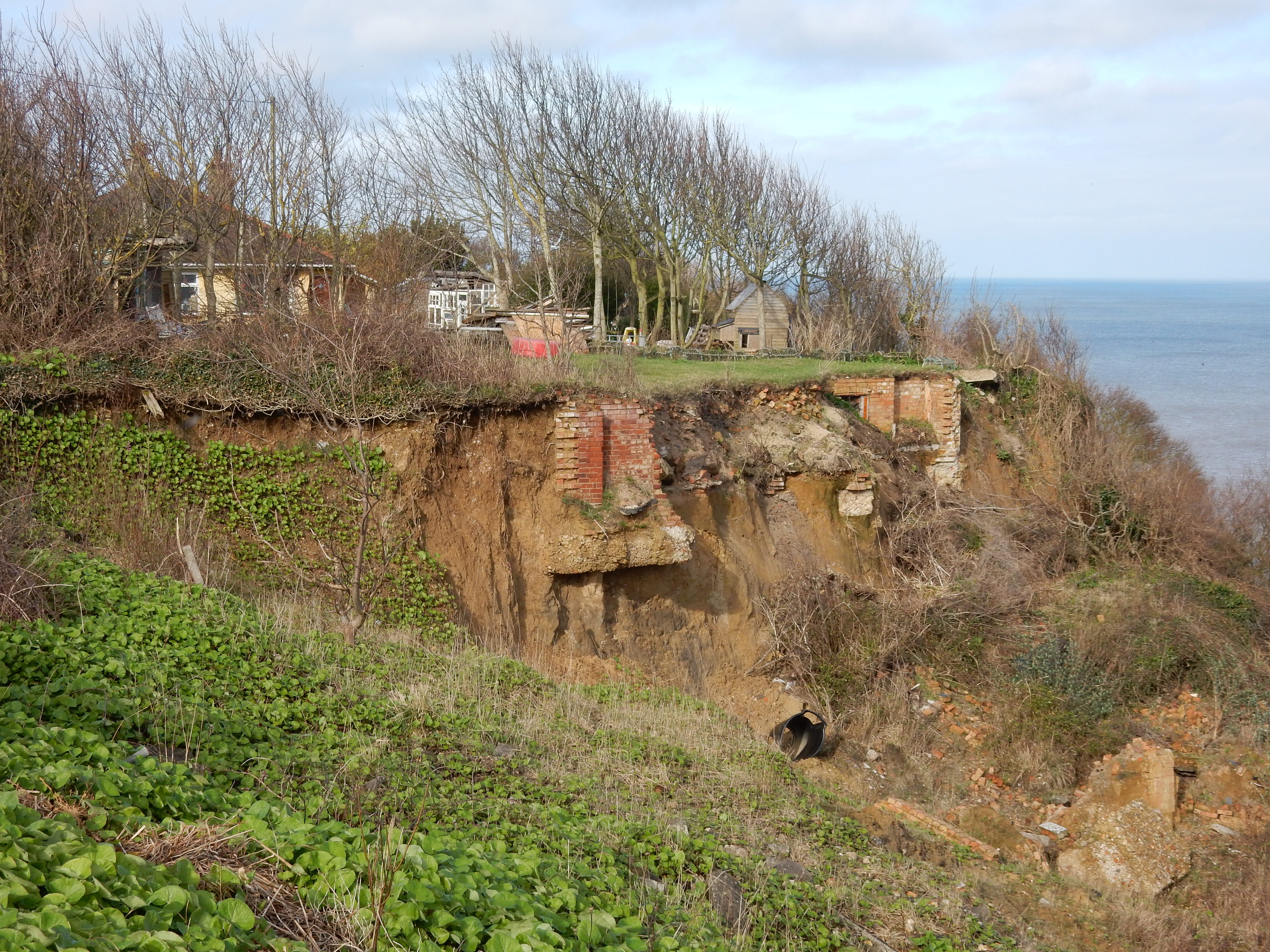
The Paston Way (for such you are walking) continues north past the Cromer radar, and under a bridge carrying the abandoned NSJR[5] rail line on its way to Trimingham[6]. A dash across the coast road takes us into Overstrand along with what the OS today calls the King Charles III England Coast Path . Here is our first good look at the North Sea. The benefits to one's constitution of a dip in this expanse of briny are recommended to me. Am I tempted by the suggestion? In fact, the only questions I consider are navigational ones. I get the answer wrong by turning left here and taking the path along the cliff top. The OS wanted, correctly, to continue down the access road to the promenade below. It becomes clear that the path I do attempt will not exist for very many years more. The homes along it are eventually going to end up like this one. Within ⅓ mile the path turns into thin air, and you are forced along an alley onto the High Street and then back down to the promenade end below Cliff Road.
Now Cromer is in sight, and looks as though you could be there in a jiffy. Don't be misled. You now face two miles of this. It's harder going than it looks. Cromer never seem to get any nearer, no matter how far you trudge. Only when you reach the famous beach huts can you breathe a sigh of relief because the Cromer esplanade is then underfoot. I eat a forlorn packed lunch here outside the Rocket Cafe, having spent five minutes drying rain off the seat. Should have gone in and had some warm soup.
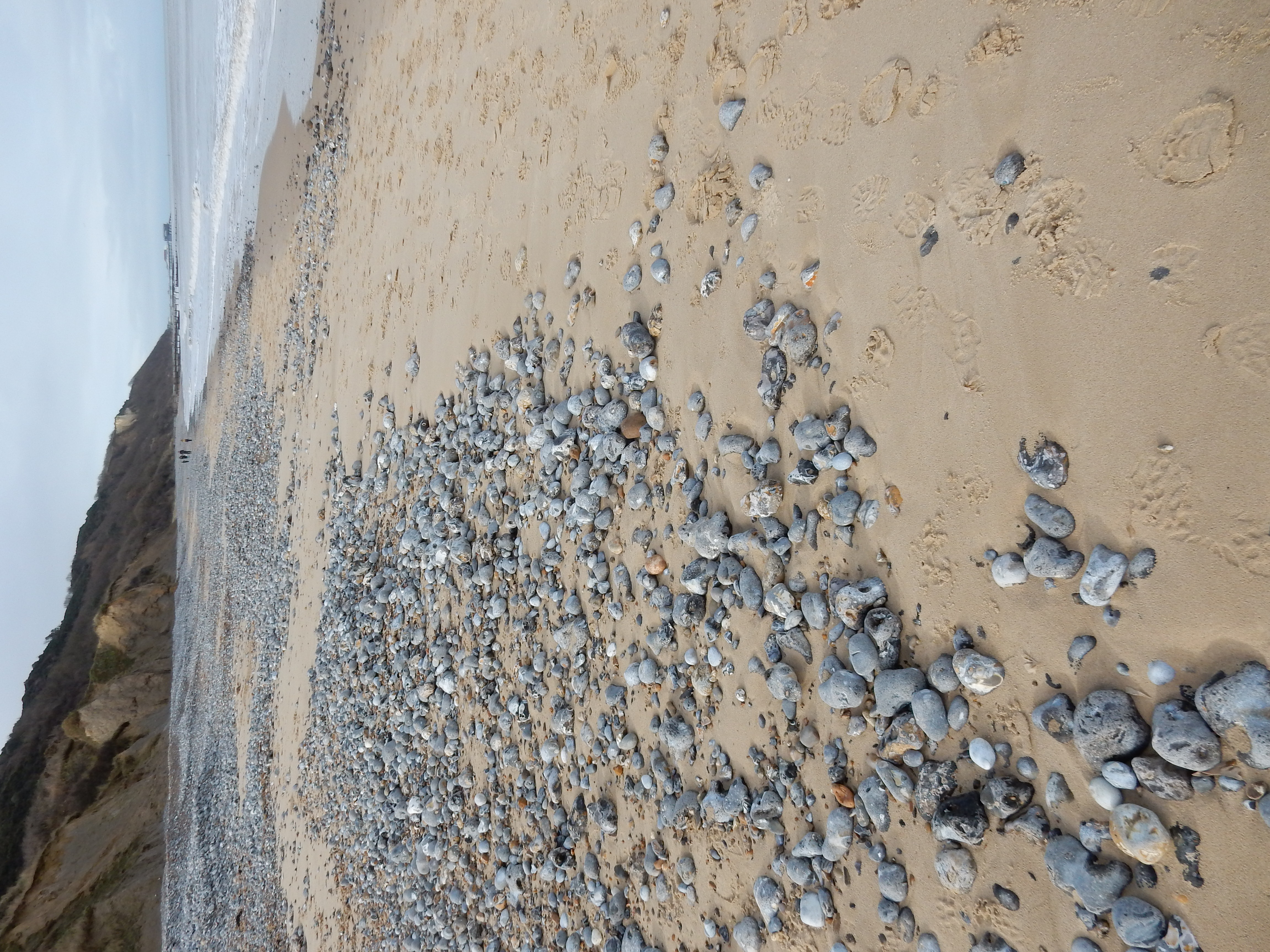
Oh, well. Onwards and westwards. There is ⅔ mile of esplanade left before a return to the dreaded shingle. The OS, for reasons best known to itself, decides to ascend the zig-zag slope at Cromer, and continue along the cliff top, all the way to Sheringham. Perhaps, with a very unfavourable tide, this would be necessary but, IMHO, the shingle beach is a shorter, though more exhausting, route to East Runton. There I climb the access road and join the OS route but, I wonder, if a beach route to Sheringham is viable 🤔
The public footpath takes you through Woodhill Park caravan site. Being closed for the winter, this has a rather spooky feel to it. Give me a shrieking pit any day. If you encounter mammoths. or other spooktaculars, then don't complain you weren't warned.[7]. Next up is another beach access road: West Runton. Same choice as before. Like the OS, I recommend cliff top. Well do I remember the stretch past Beeston from my holiday two year's previously. That, also, was rather early in the year, and my cap literally blew off then at Beeston Bump. Is that why I forgot it today? You, too, will likely also hear ghost train noises from the Poppy Line.
In short order you hit the esplanade at Sheringham. That's more or less it for this walk. The expectation of Sheringham in February was that of a ghost town. Who would want it? Well, the answer turns out to be half of Norfolk. It's buzzing with folk not just doing a Saturday shop but also doing the leisure thing. East Anglia's answer to Brighton. However, mindful of the day's weather warning, I hurry back to the car at the Station Car Park. Après moi, le déluge.