
Parametric data
- Route name:
- Mottingham
- Start point:
- Mottingham.
- End point:
- Ilford.
- This route on OS maps:
- https://explore.osmaps.com/route/16519671/ ...
- Distance:
- 10.3 miles walked, 8.3 miles flown.
-
3.6 hours.[1] - Topology:
- Point to point (Northward).
- Ascent:
- 93 metres.
- Stiles:
- 0 (zero).
- Landmark of note:
- The Foot Tunnel North Portal.
- Feasible excursion:
- I looked at routes on the east bank of the River Roding, but they aren't shorter nor, on the day, did they spare me any mud.
- Waypoints:
- Eltham, Shooters Hill, Woolwich, North Woolwich, Cyprus, Beckton, East Ham, Little Ilford.
-
Weather: -
 13°C,[2] ☀️ Barely a cloud in the sky.
-
Avoiding roads: -
One or two routes shared with bikes.
-
Footpath construction: -
100% Tarmac.
-
Footpath condition: -
 Small quantities of mud around Beckton. I hope it was mud 🫢
- Refreshments:
- Coffee at Eltham Cafe. Lunch at Starbucks.
-
Vistas: -
 There is no way to cross the Thames on foot and get less of
a view of it.[3]
There is no way to cross the Thames on foot and get less of
a view of it.[3]
Blackberries:-
Tescos is never far away.[4]
Route map.
Route notes.
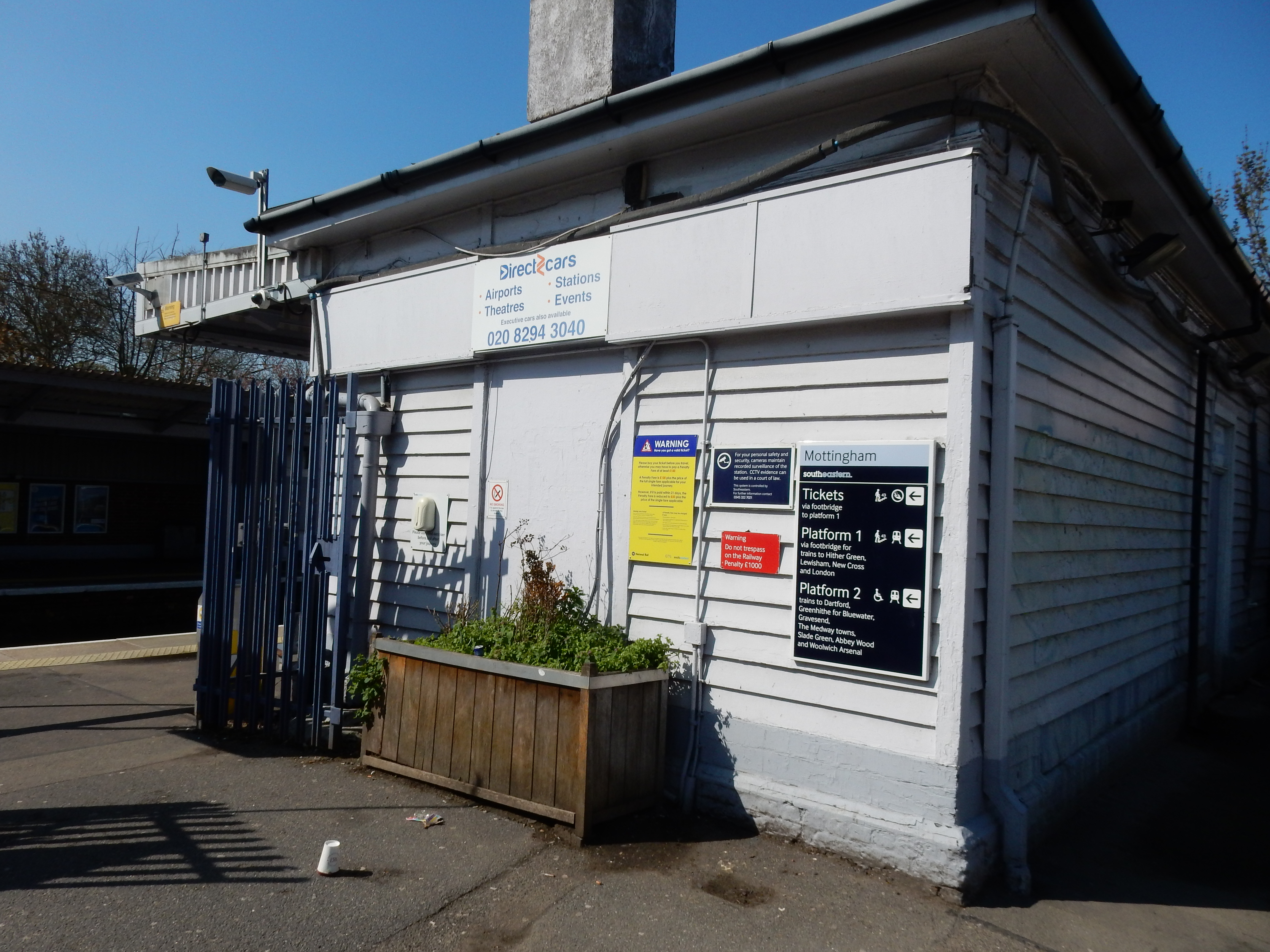
- -Begin walkat Mottingham rail station.
- Aft. 0 mTRalong Station Approach
- Aft. 55 mTJLalong Court Rd.
- Aft. 1200 mCross Eltham
High St.into Court Yd. - Aft. 500 mGo over A2onto Well Hall Rd.
- Aft. 1850 mCross Shooters Hillinto Academy Rd.
- Aft. 1040 mContinueinto Woolwich Com.
- Aft. 380 mContinueinto Woolwich New Rd.
- Aft. 120 mBear Linto Grand Depot Rd.
- Aft. 410 mBear Linto John Wilson St.
- Aft. 750 mTRinto Woolwich High St.
- Aft. 80 mTLinto Glass Yd.
- Aft. 105 mTRinto Woolwich Foot Tunnel
- Aft. 505 mTRinto Pier Rd.
- Aft. 260 mTRinto Albert Rd.
- Aft. 1500 mGo roundinto Woolwich Manor W.
- Aft. 310 mTRinto FP
- Aft. 100 mTJLinto FP
- Aft. 50 mBear Rinto Oxleas
- Aft. 71 mContinuealong FP[5]
- Aft. 1040 mTLthrough retail CP[6]
- Aft. 240 mCross Claps Gate Ln.into Beckton Triangle
- Aft. 90 mTLinto Sainsburys Rd.
- Aft. 70 mTRinto FP left of Harveys
- Aft. 150 mContinueover footbridge
- Aft. 120 mTJLinto Goosley Ln.
- Aft. 83 m1st Rinto Folkestone Rd.
- Aft. 545 mCross Flanders Rd.into Park Ave.
- Aft. 526 mCross A124into Wall End Rd.
- Aft. 670 m8th Rinto Burges Rd.
- Aft. 145 m2nd Linto Leigh Rd.
- Aft. 314 mTJRinto Stevenage Rd.
- Aft. 385 mTJLinto Barrington Rd.
- Aft. 56 m1st Rinto Gainsborough Ave.
- Aft. 502 m2nd Rinto Church Rd.
- Aft. 50 m1st Linto Walton Rd.
- Aft. 660 mTJRinto Romford Rd.
- Aft. 200 mGo under
N Circular Rd.into Ilford Hill - Aft. 382 mTLinto Cranbrook Rd.
- Aft. 90 m1st Linto Ilford station
- Aft. 0 mEnd walk-
Peaches and cream. Samson and Delilah. Trafalgar and Nelson. Atom and nucleus. Politics and corruption. Think of one name, and the other springs to mind. How about London and Mottingham? No, it doesn't quite work, does it? In fact, prior to this walk, the latter location was not one ever to have penetrated my consciousness at all. It may well never do so at any future event. It was chosen here for its rail station, five-ish miles south of the Woolwich Foot Tunnel.
So, an offbeat choice, but a good one never the less. Or might have been had my 09:33 train not been cancelled after it "... left the depot late." How intriguing. Had the unfortunate item of rolling stock not set its alarm clock the previous evening? Perhaps it got up with a sore bogie and was obliged to administer some axle grease? Train and delay.
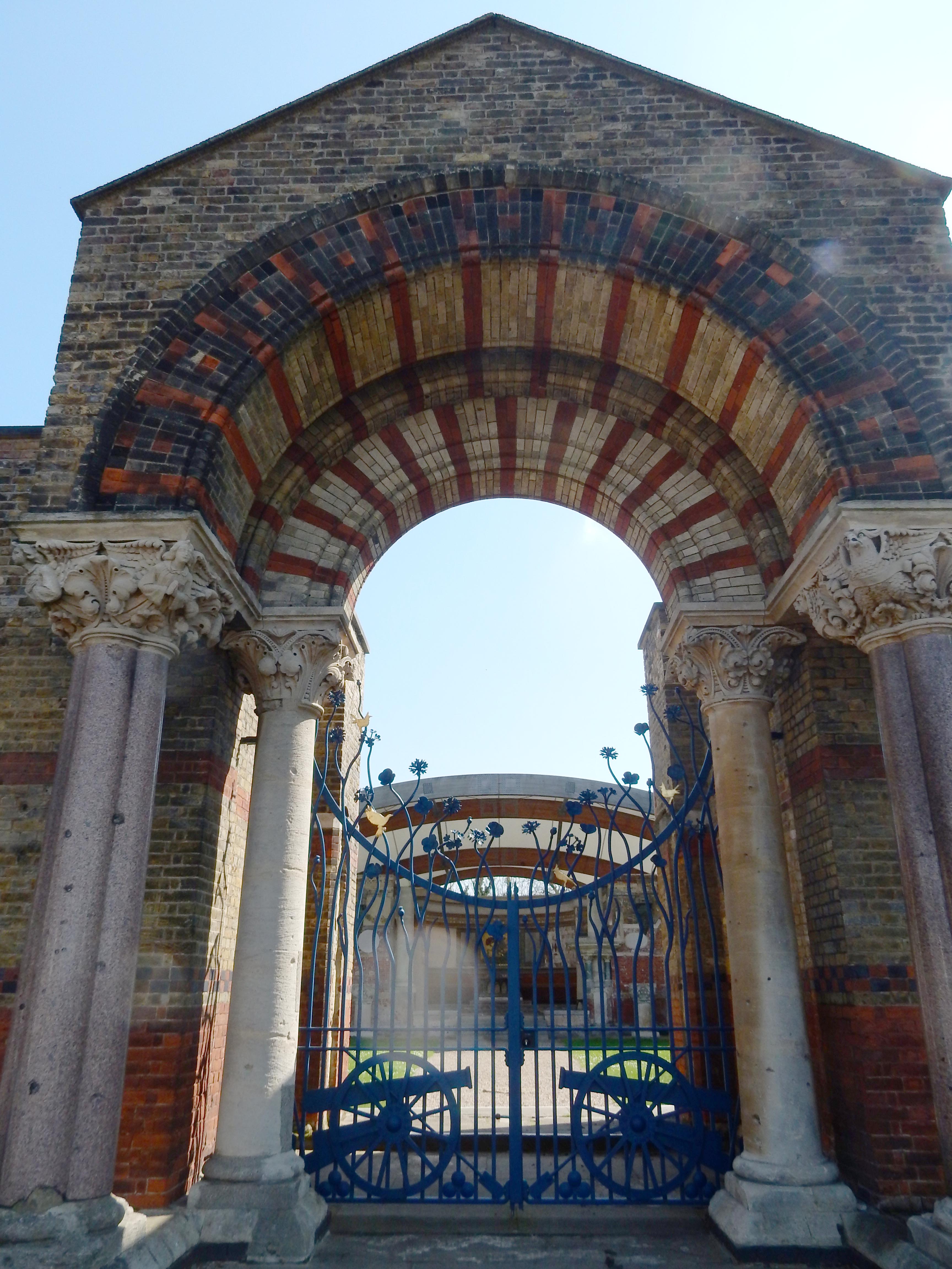
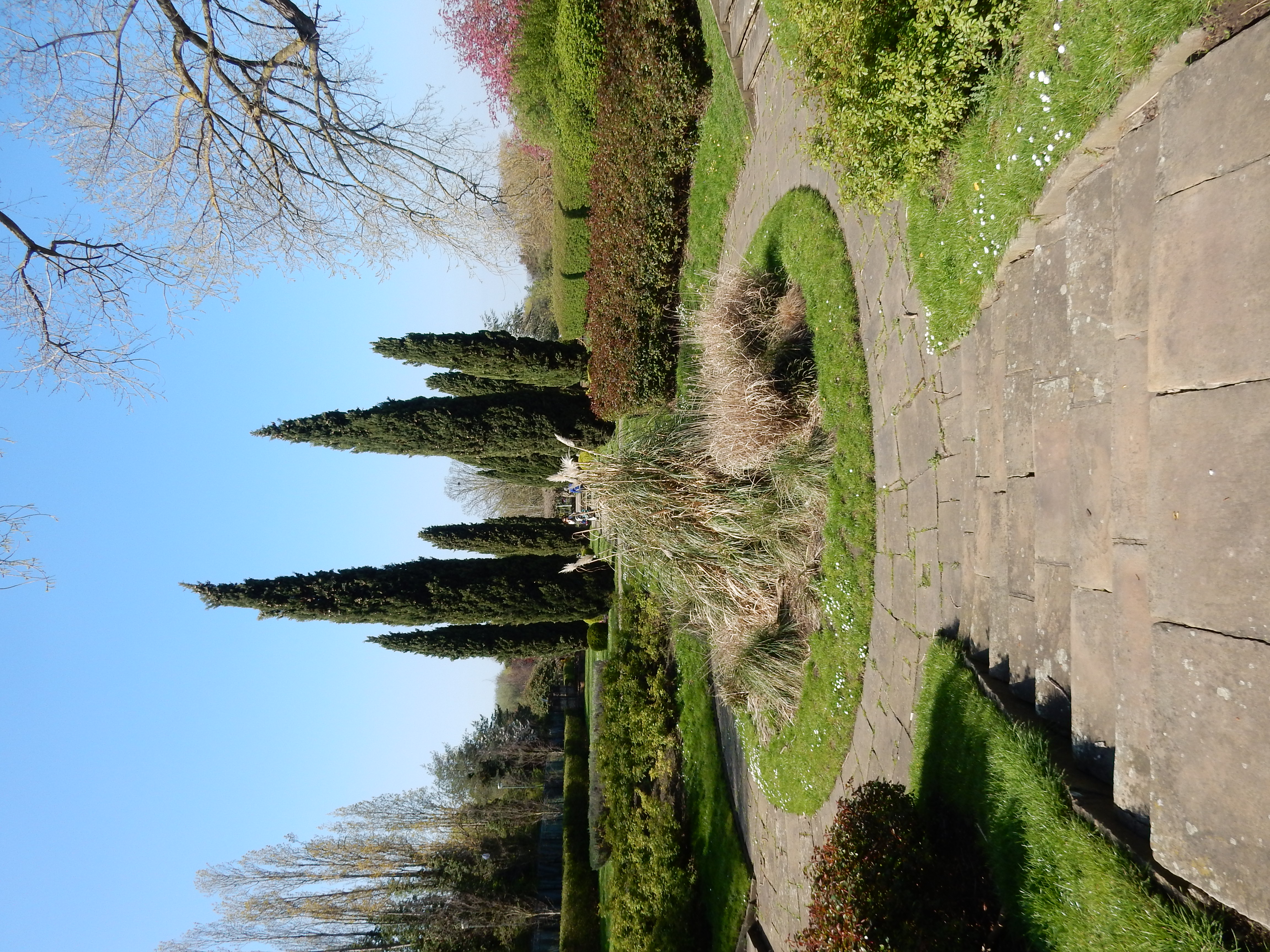
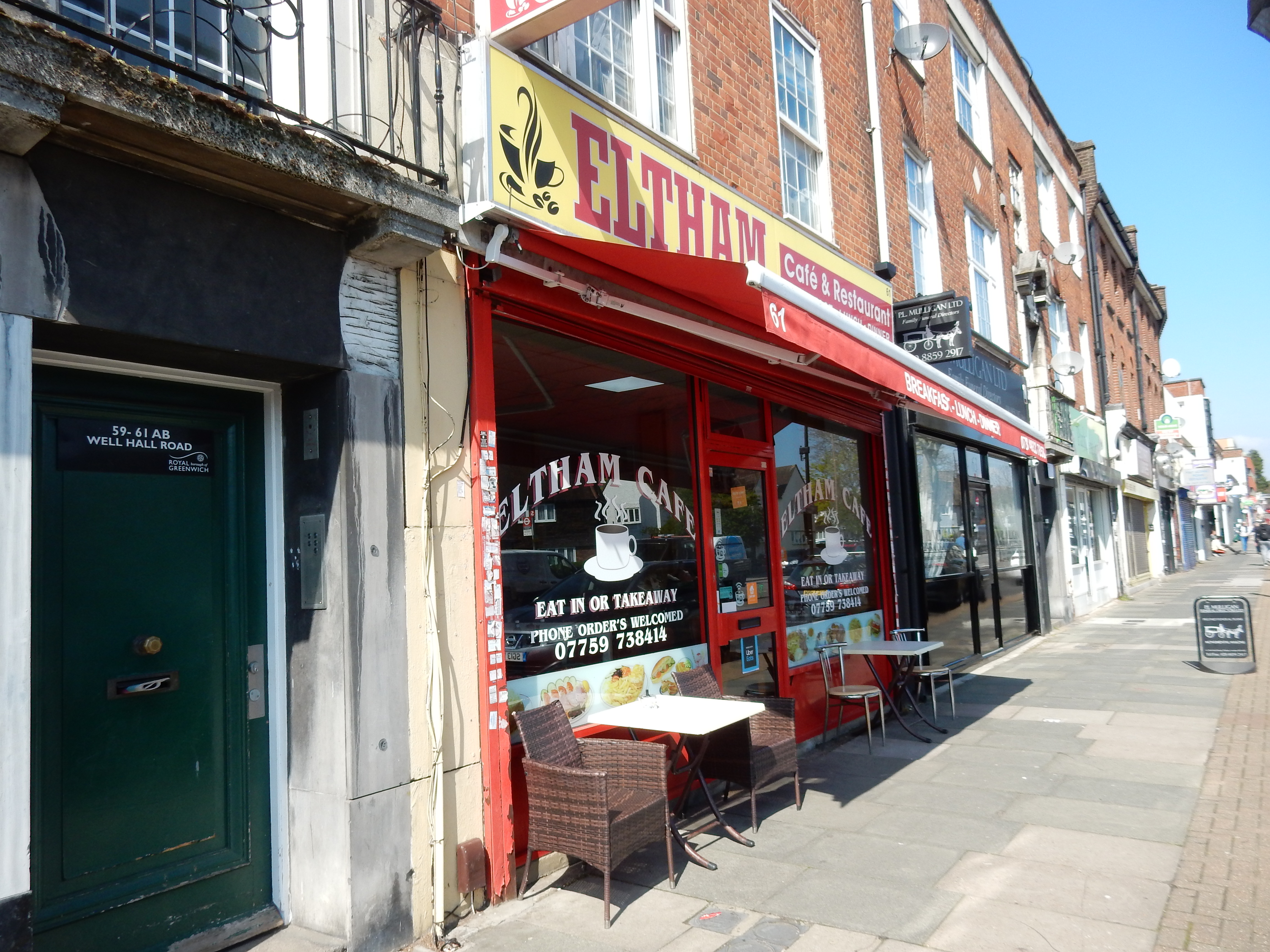
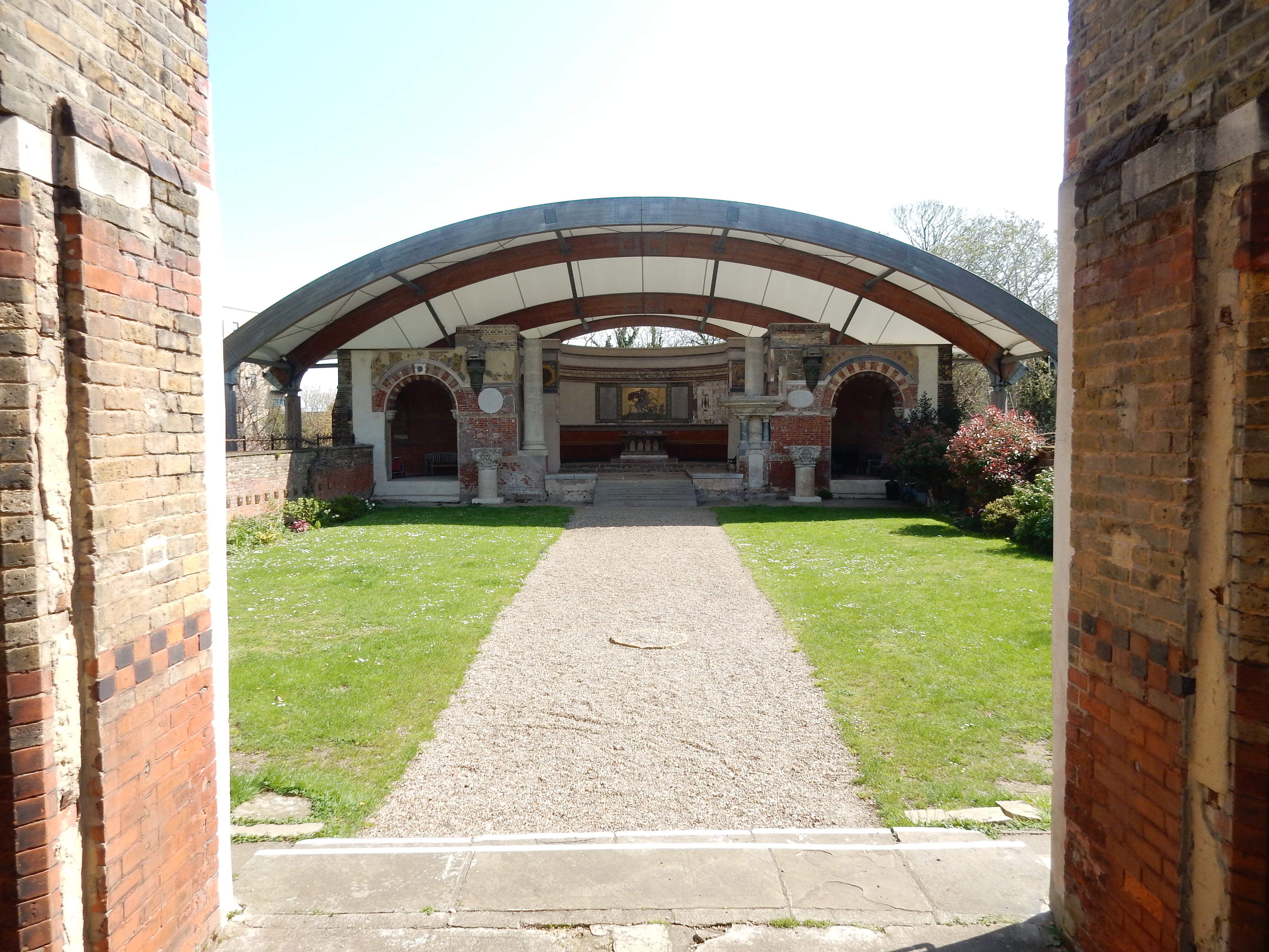
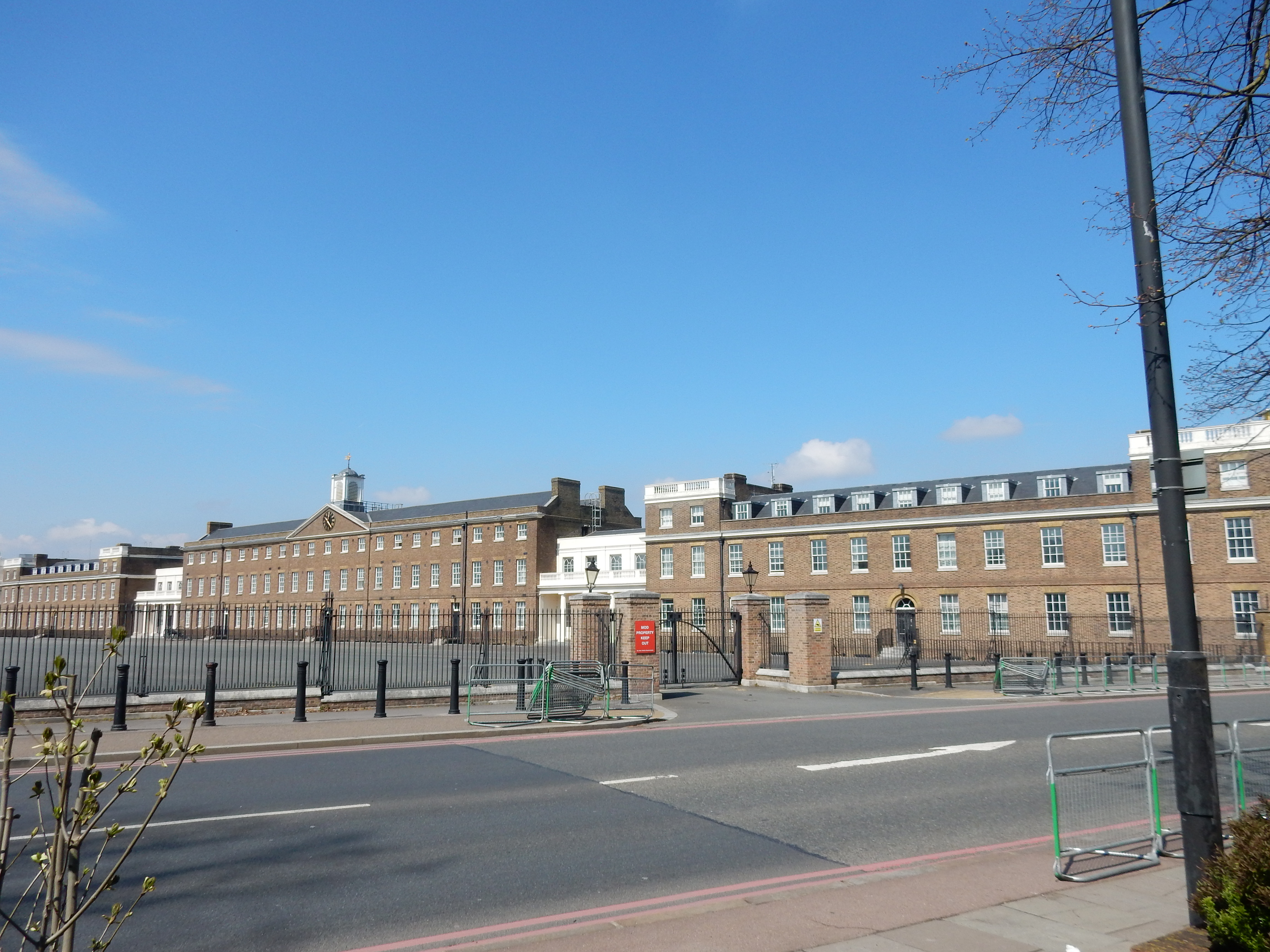
All the same, the first half of the walk is very easy. You point yourself north and keep going until you hit the Thames. Simples. If you wish, stop to admire the old fashioned park at Eltham. BTW, the cul-de-sac on the south side of the Pleasaunce is called Edith Nesbit Walk as tribute to that author who lived in Well Hall. Have coffee at the Eltham Cafe,[7] take a photo of St George's Garrison Church, fire off another shot at the Royal Artillery Barracks.
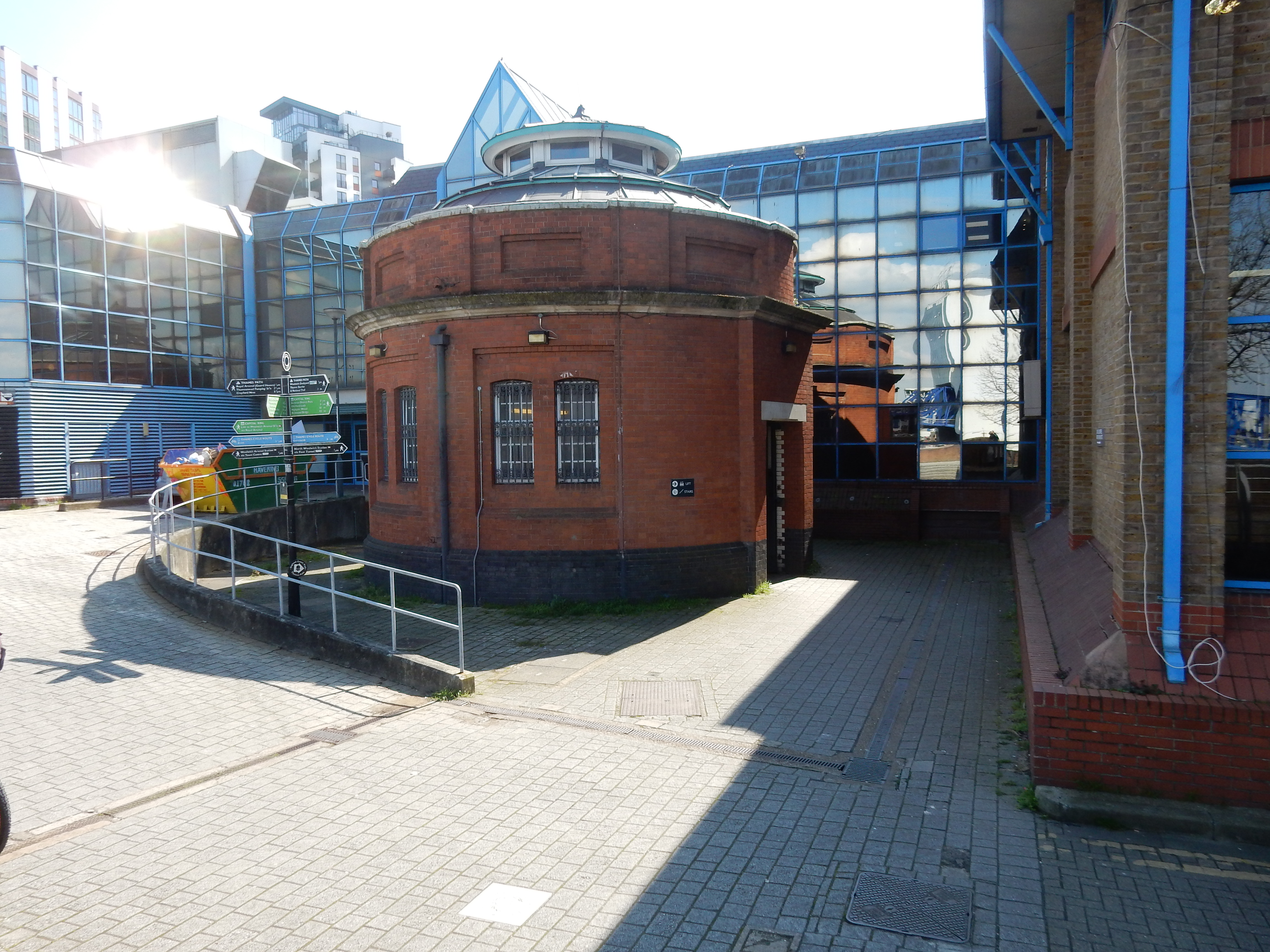
The Foot Tunnel was opened in 1912 (the same year the Titanic went underneath the waves). My guess is that the project only became feasible once electric lighting had become practical. What of its sister tunnel at Greenwich a decade earlier? Both projects were intended for the benefit of dock workers living south of the river (where accommodation was relatively cheap) but travelling to the Royal Docks where the work was.
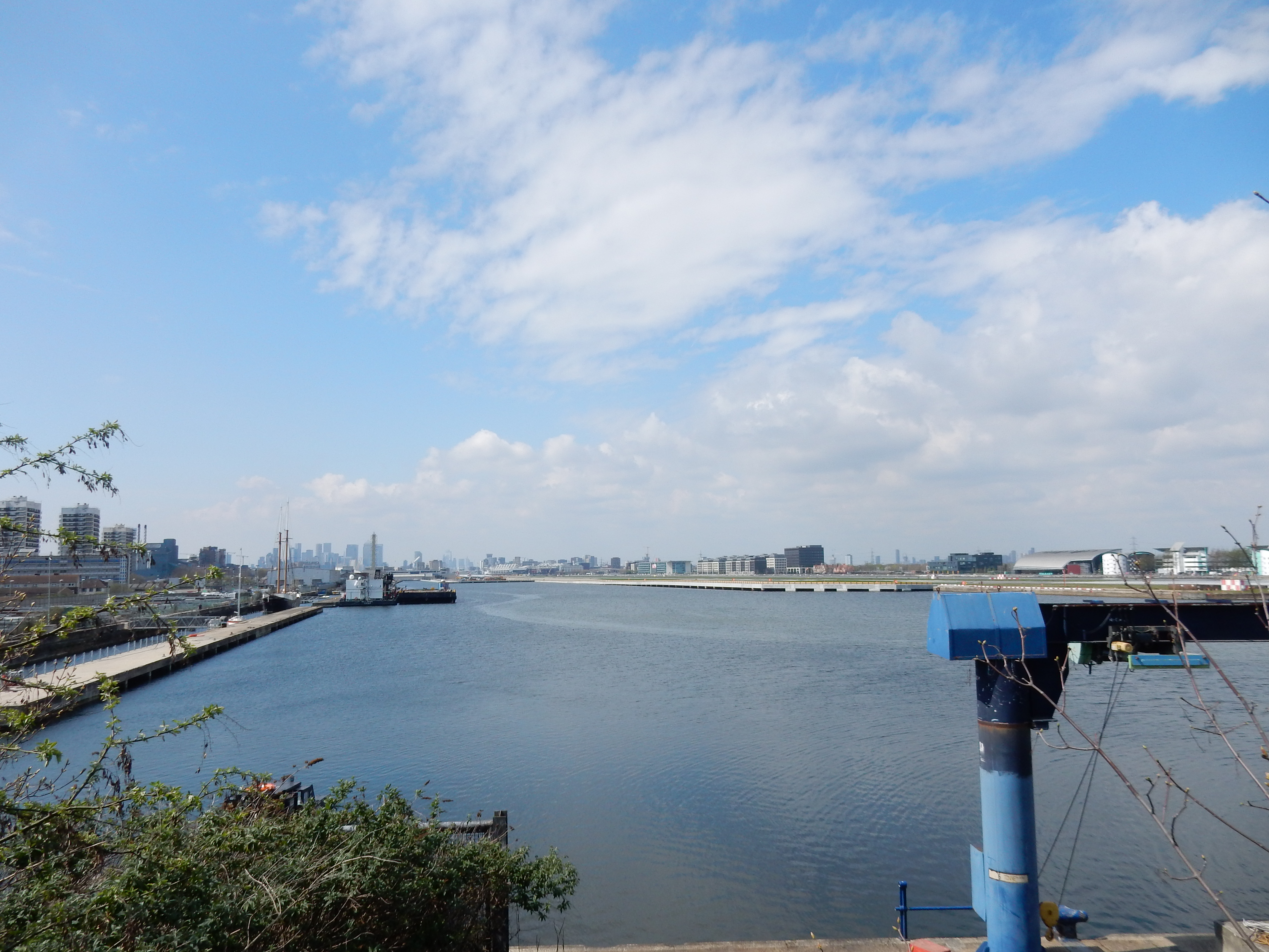
The south portal is not easy to find, being tucked away behind Woolwich Leisure Centre, down an unportentous side street: Glass Yard. There is a sign, but you have to look carefully. The good news is that the lift works at this end, but pause a moment to get your breath and look upstream towards the Woolwich Ferry Terminal.[8] Just ¼ mile along are the remains of the Woolwich Dockyard where recently investigated maternal relatives were based. Eastwards, in the direction of Thamesmead, observe the river to open out considerably. In the allegedly photogenic tunnel itself you can take a photo, or not, as you please.
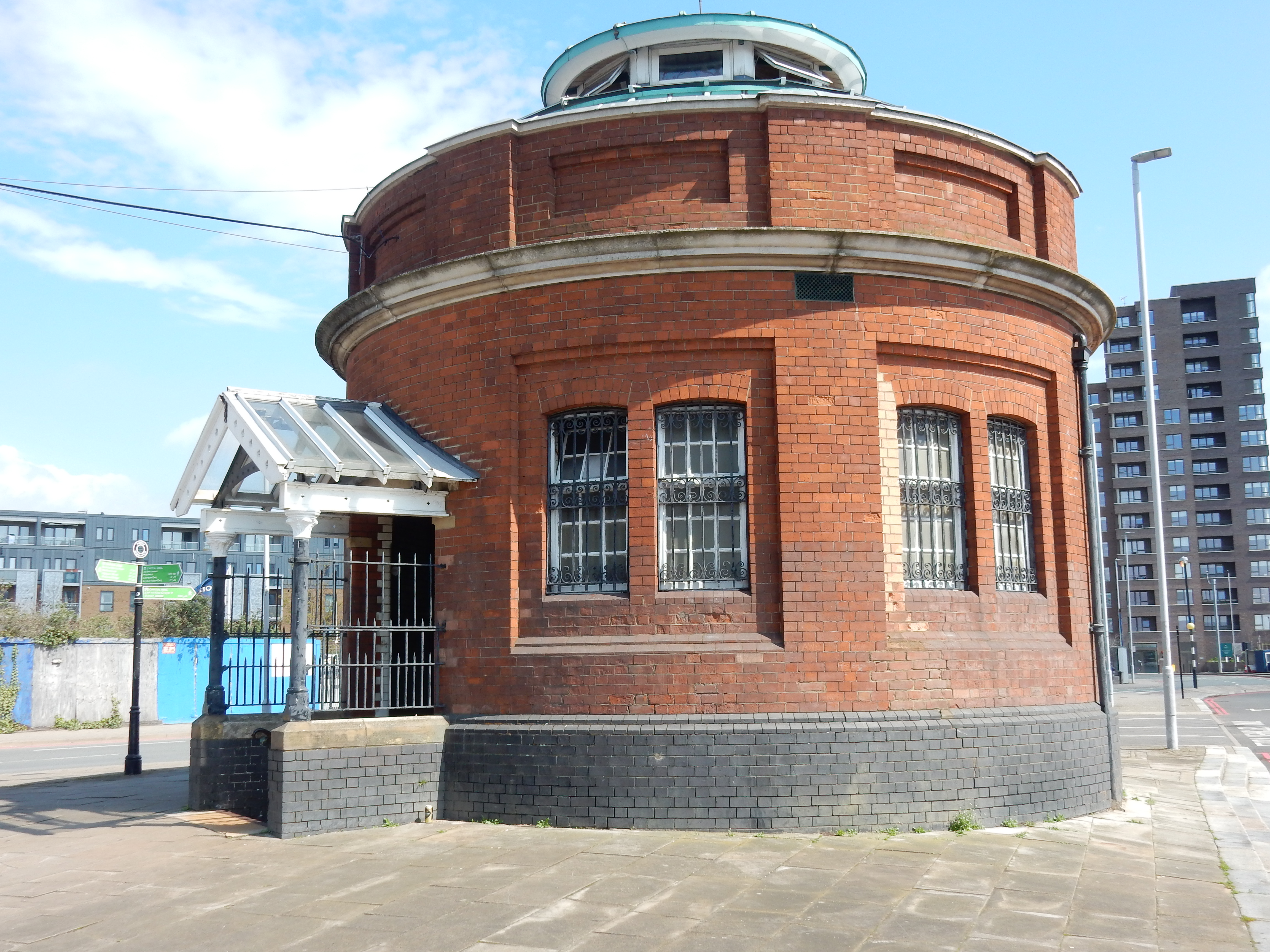
The north portal finds itself in rather different surroundings. Originally, it stood between Stanley Road (running close by the river) and some railway sidings branching off the line that ran to North Woolwich station from Connaught Road railway station at the Royal Victoria Dock. All that infrastructure is now either defunct or completely swept away. Some went after changes to the early train operators, visitation by the Luftwaffe, dwindling upstream docks usage, growing road haulage or 1980s redevelopments such as the DLR. Whatever, various grand designs for the area failed to materialise and the portal now stands isolated on a windsewpt terrace.
Navigation north of the Thames is more difficult due to 1.3 miles of the former Royal Albert Dock blocking your path. An impediment to progress is what we have since announcements in 2013 of spectacular redevelopment plans. We must thank Covid, apparently, for several acres of centrally located real estate unused for diddly-squat. Is that right, Jimmie?
Out with GPS now to get you the rest of the way to Ilford. I looked at routes on the east bank of the River Roding, but they aren't shorter nor, on the day, did they spare me any mud. The route shown is pretty much what the OS app selected, and I doubt that you could do much better. Anyway, pause a couple of minutes before going over the Albert Dock to watch planes take off from the City Airport.
The magic of the drain
Is a thing you can't explain,
But it's calling us again,
Down below.
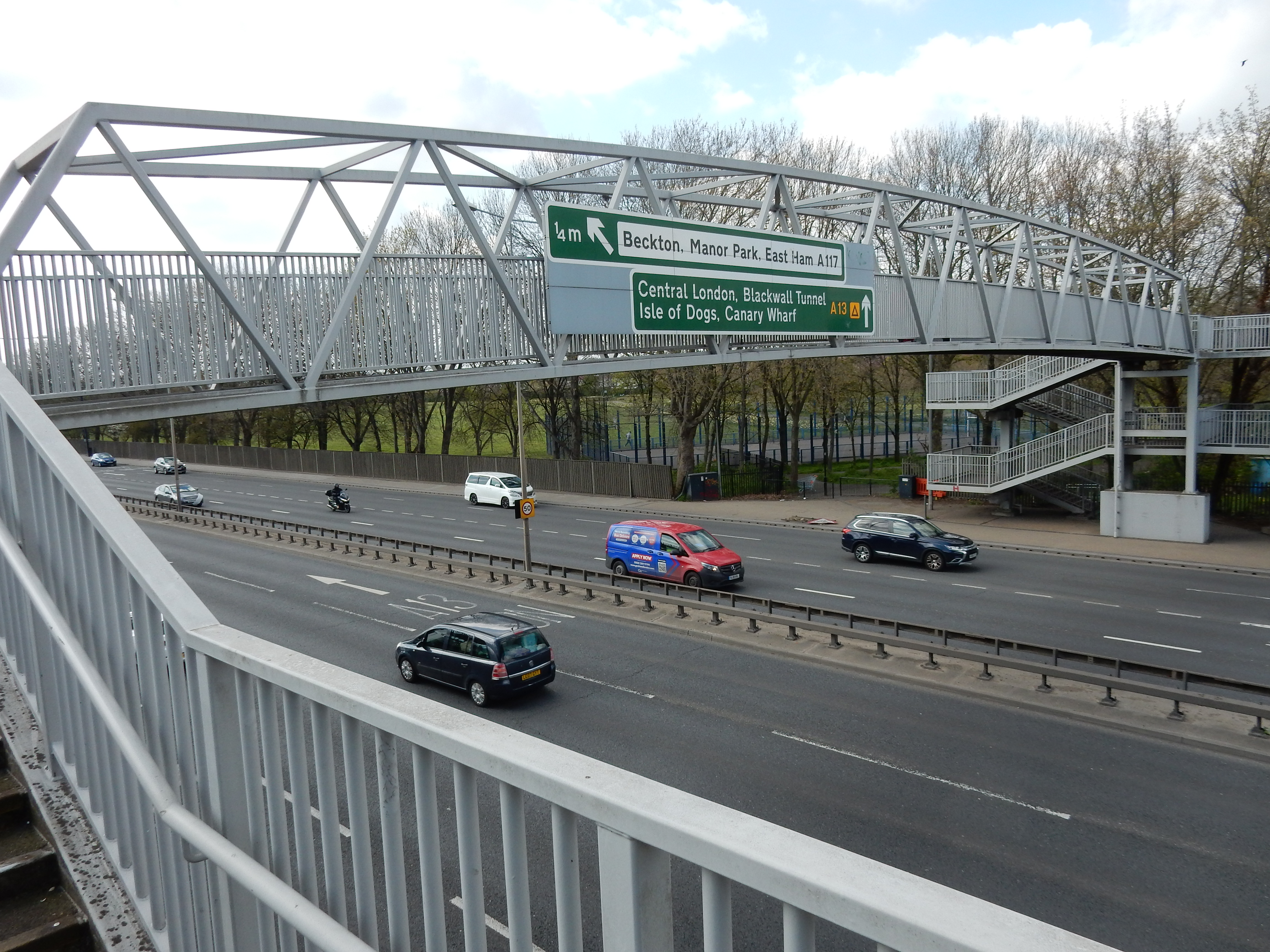
From the Gallions Roundabout northwards, follow the footpath just to the west of the A1020 Royal Docks Road for about a mile. This has a sealed surface and has no mud problems. Depending on the wind direction, it may have an odour problem. You're in Beckton. I wonder, given the issues with the supply of Natural Gas from Russia, whether the Beckton Gas Works might find its long retirement being interrupted. Are all our appliances soon to revert to 'Town Gas', as it was called when I was young? If so, it could be bad news for someone in my family that might be employed in the operation.
Malodorous though parts of Beckton may be, my lunch here is not spoiled and, by the time I cross the A13, nothing fills my lungs except the purest carbon monoxide. The remainder of the walk is mostly 2½ miles of suburbia. The road names cause temporary disorientation: Folkestone Road, Brighton Road and Eastbourne Road. Have I taken a wrong turn and ended up on the south coast? No, this is East Ham alright. Yea verily the A124 Barking Road where my mother's family lived at her birth in 1924.