

Parametric data
-
Route name:
Holmwood station. -
Distance:
11 miles. -
Topology:
Point to point (north eastward). -
Seasonal suitability:
Dry. -
Ascent:
100 metres+ -
Landmark of note:
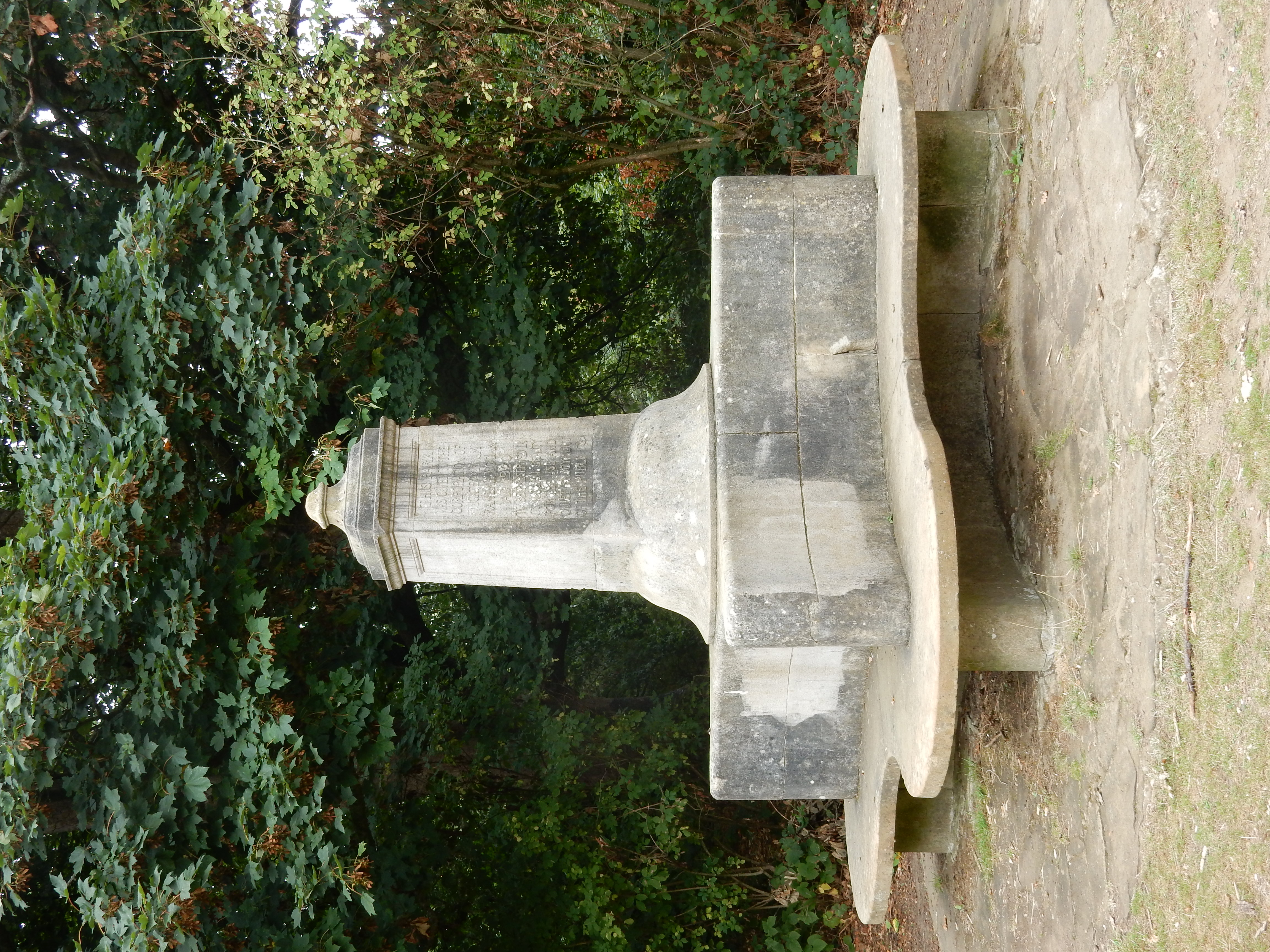
Randal Vogan memorial -
Feasible excursion:
Stay south of the Priory and cut across to Shaw's Corner and the A25 through Redhill. Might save ½ a mile. -
Walking in the road:
Maybe 1.5 miles (Clayhill Road), but little that is really terrifying outside peak hours. -
Footpath quality:
Varied. Uncertain about the South Holmwood water treatment section at the moment. -
Duration
4.3 hours -
Refreshments:
Pistachios.
Route map and notes.
The first two miles or so follow the rail line quite closely but, inside of 100 metres from the station, your surroundings become more rural than suburban. Favourable drought conditions dry out most of the cow pats. Ah, fresh, country air; that's what we need.
At 1½ miles you reach the sewage treatment works (fresh, country ... oh, never mind) which the path turns sharply toward. Rather than follow my nose I carried straight on and was soon in difficulty. The blackberries here tempt less than usual.
The next 1½ miles is, technically, road walking but is actually a glorified farm track. You may encounter nothing but the Post Office van. Thereafter you have a mile of Clayhill Road. Not to be recommended during rush hours but it has a verge along the outside of most of its bends. That takes you into Leigh and an early stop at the Plough, if you need one.
From there, lookout for the point at which the road turns north while the path cuts diagonally across the fields further east. Approaching Denshot Farm, the fields become smaller and the route gets complicated traversing streams feeding into the Mole. Olympic athletes will appreciate the challenging styles across this way.
The short stretch of Flanchford Road was closed to vehicular traffic on the day. In a season as dry, I can't imagine that the Mole would give it problems. Well, the end of the bridge has a right turn south of Flanchford Farm. There's not a lot to see before you hit Slipshatch Road but you are spared the worst of Flanchford traffic.
After a left, right, left you can begin your ascent from the river up to Reigate Priory, 70 metres above. Check oxygen tanks beforehand. The excursion through the middle of the Priory was not to see the totally desiccated Priory Pond, but for lunch at Pistachios. Poor Randal Vogan. What would he say to the multitude of young families in the park he intended for their 'quiet enjoyment'?
Leave the Priory across Bell Street for a footpath, starting near its junction with Lesbourne Road, taking you toward St Mary's curchyard. Starting there is another and rather curious path that appears to have cut across the present alignment of road and rail for nearly a mile along to Donyngs. It is shown on the Survey of 1869, but must be older than that.