Parametric data
- Route name:
- King's Lynn
- Start point:
- King's Lynn, also shown on ///what3words.
- End point:
- Hunstanton, also shown on ///what3words.
- Synopsis:
- A medium distance route[1] comprised entirely by a stretch of the King Charles III England Coast Path along the Norfolk side of the Wash,[2] following the flood defence embankment almmost the entire way. Travel to the start by bus.
- This route on OS maps:
- https://explore.osmaps.com/route/31299927/ ...
- OS Explorer sheet ref(s):
- 250.
- Distance:
- 16 miles walked, 12.5 miles flown.
- :
- 6.0 hours.[3]
- Ascent:
- 14 metres.
- Stiles:
- 0 (zero).
- Landmark of note:
- TBA
- Feasible excursion:
- You can start further south if you wish to see the older part of Lynn, or visit the museum.
- Waypoints:
- Wolferton, Shepherd's Port, Heacham.
- Fuel:
- Packed lunch at the TBA.
- :
-
 12°C,[4] ☀️
A nippy south-easterly breeze.
12°C,[4] ☀️
A nippy south-easterly breeze.
-
Free of in-road walking: -
 TBA
TBA
-
Footpath construction: -
TBA
-
Footpath condition: -
TBA
Route popularity:-
Who I saw ...
-
Vistas: -
TBA
Blackberries:-
TBA[5]
Route map.
Walk notes.
This walk is one of my more impromptu expeditions; devised at short notice. Inpiration for it may have come from the recent announcement that the King Charles III England Coast Path was declared open on the 19th ult.[6] I have already done a couple of sections of KCIIIECP, and will likely tick off a few more of the easier stretches like this.[7] My preference is for walks on the flat, and this one has an ascent of 14 metres over the entire 16 miles. Even for Norfolk, not famous for its mountainous terrain, that is more on the level than any walk I have yet attempted. At last, my nightmarish week ‘on the huh’ in Glen Coe last year fades from memory.
Not that I am entirely sanguine about comfort levels today. The forecast may claim 0% chance of rain today but, to go with that, we are threatened with a "moderate breeze". I understand perfectly that this phrase translates to "Any without protection from that which slams into them straight from the North Sea must expect hypothermia."
A further difficulty is that I cannot take a train to Lynn for the start of this walk. The Sheringham side of the county, where I am presently accommodated, is a tortuous three hours by rail. In any case, Hunstanton is without a station, so then what? Instead, it's a drive there, and take the #36 bus to Lynn. This plan has its problems, too, because a road is closed somewhere near Docking and I loose several minutes attempting to convince a satnav of its ignorance. In consequence I arrive later than planed at Hunstanton in the wrong car park. Off season, happily, there is parking available. It's yet another question, though, whether I should squander ¼ tank of fuel whilst the current fun and games continue in the Middle East. It's an expensive hobby: walking.
My walking boots are donned too hastily and I arrive at the bus stop experiencing some discomfort in my right foot. This problem is rectified by emptying two Euros and ninety cents in loose change from the boot where I had stashed it at the end of my walking holiday a week previously. I have no doubt that all others waiting for the bus understand what prompts my déshabillé. Furthermore, those who fancy a closer look at King's Lynn have the option to stay on the bus a stop or two longer on the A1078 as it goes toward the centre of Lynn, where the historical town can be seen.
However, said boots, my winter ones, prove inappropriate either for the purchase of bus tickets[8] or for this walk along the coast. My expectation is, at least, for some mud, soggy sand or puddles. Instead, I get 16 miles of bone dry terrain at 20 degrees, low tide, plus full sun. My feet overheat, and the ensuing blister is the largest so far acquired by me 😬 OK, it's time I started this stroll.
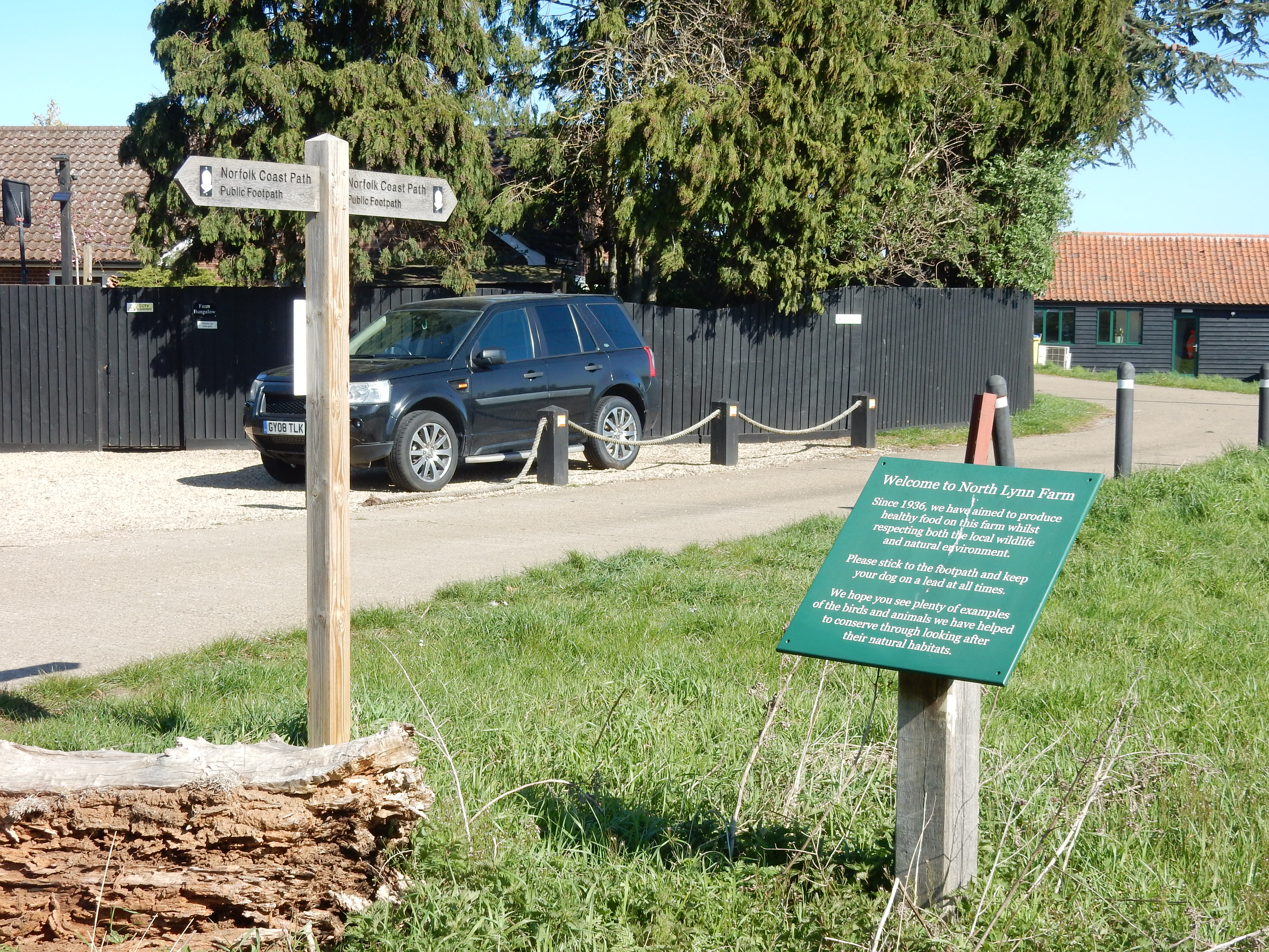
As with most of my walks, the first ½ mile is characterised by tarmac and not much countryside. The latter comprises stockyards for goods entering or leaving the port, and the breeze carries a scent from piles of imported timber intended for construction purposes. Thereafter, the KCIIIECP goes off-road through North Lynn Farm. I would happily comply with the usual injunction to 'stick to the footpath' except that, for ¼ mile, it has been ploughed up and a crop planted over it. Am I supposed to ask KCIII to tell me where his path goes? I do my best with GPS but feel that I should not need to on a National Trail. Well, I said it's a work in progress 🤷♂️