

Parametric data
- Route name:
- Shepherdswell
- Start point:
- Shepherdswell.[1]
- End point:
- Dover.
- This route on OS maps:
- https://explore.osmaps.com/route/22273640/ ...
- OS Explorer sheet ref(s):
- 138.
- Distance:
- 9.6 miles walked, 5.8 miles flown.
- :
- 4.6 hours.[2]
- Ascent:
- 251 metres.
- Stiles:
- 0 (zero).
- Landmark of note:
- Disused railway at Coldred.
- Feasible excursion:
- You could follow the rail line from Shepherdswell into Dover via Kearsney but, apart from shaving a couple of miles off the route, has nothing to recommend it. See notes.
- Waypoints:
- Coldred, Waldershare, Ashley, West Langdon, Pineham.
- Refreshments:
- Coffee at Tonbridge. Sandwich lunch at Waldershare Park.
-
: -
 23°C,[3] 🌤️
Breeze was strong enough to blow my hat off. Becoming humid.
23°C,[3] 🌤️
Breeze was strong enough to blow my hat off. Becoming humid.
-
Avoiding roads: -
 About 250 metres along Roman Road passing West Langdon.
Ben-Hur
is disinclined to trim his speed ⚠️
About 250 metres along Roman Road passing West Langdon.
Ben-Hur
is disinclined to trim his speed ⚠️
-
Footpath construction: -
 There is much tarmac, and good BLA, but this is basically
dirt.
There is much tarmac, and good BLA, but this is basically
dirt.
-
Footpath condition: -
 A rare 5-nana score, but it has been windy and dry for a
couple of weeks.
A rare 5-nana score, but it has been windy and dry for a
couple of weeks.
-
Vistas: -
 Disappointing. See notes.
Blackberries:-
The hedges along
Little Haynes
obliged.[4]
Route map.
Walk notes.
🏁 Well, nearly there, at last. This walk derives from Section #15 of the North Downs Way National Trail (NDW), and folllows on from Section #14 that I completed last week. It is the final section of the NDW that I started at Farnham last year. Getting to Shepherdswell presents (a now familiar) dilemma: take the costly HS1 train from St Pancras, or the alternative, slowwwwer cross-country service via Tonbridge? I opt for the latter, and fail to arrive much before 2pm.
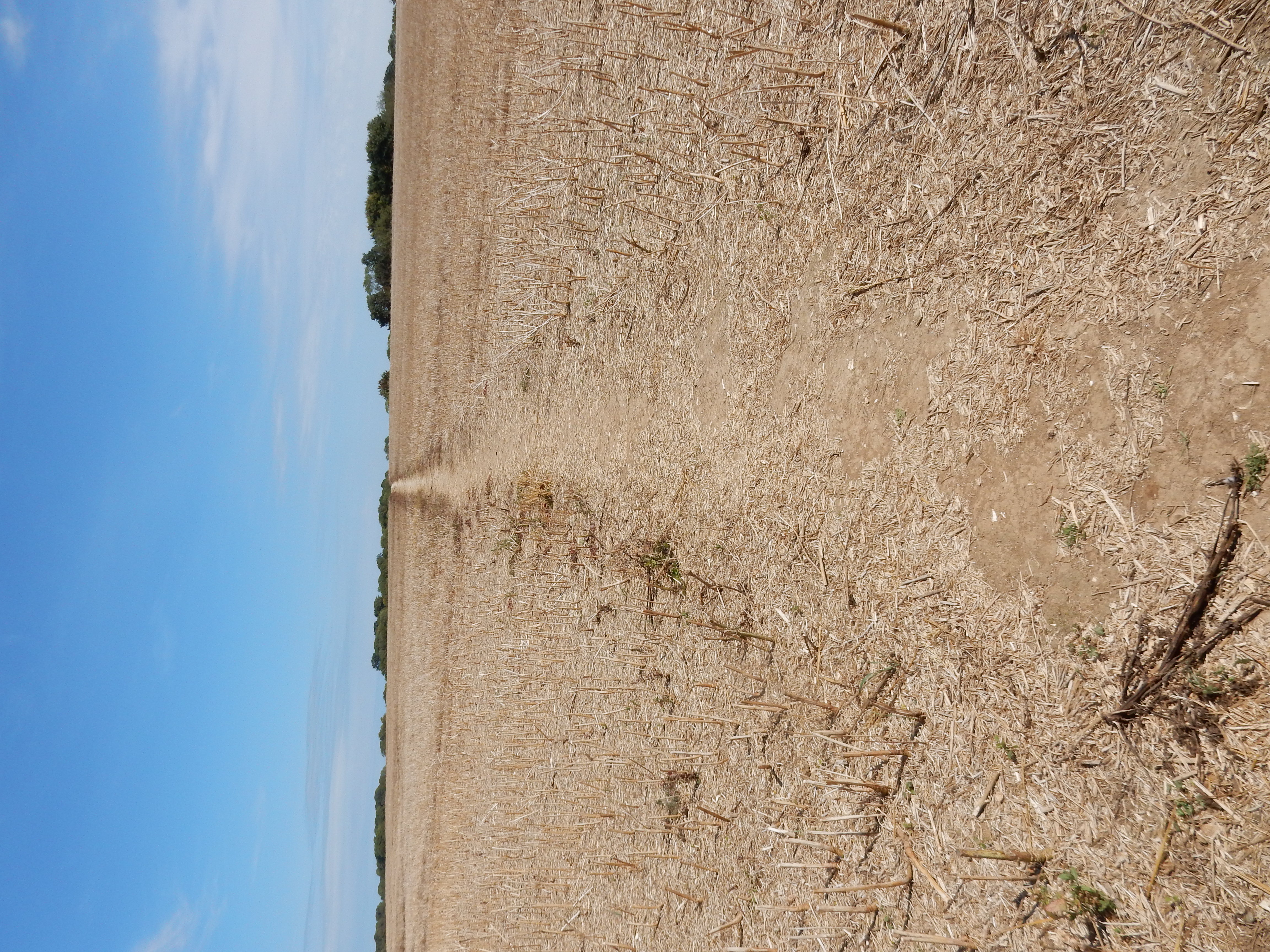
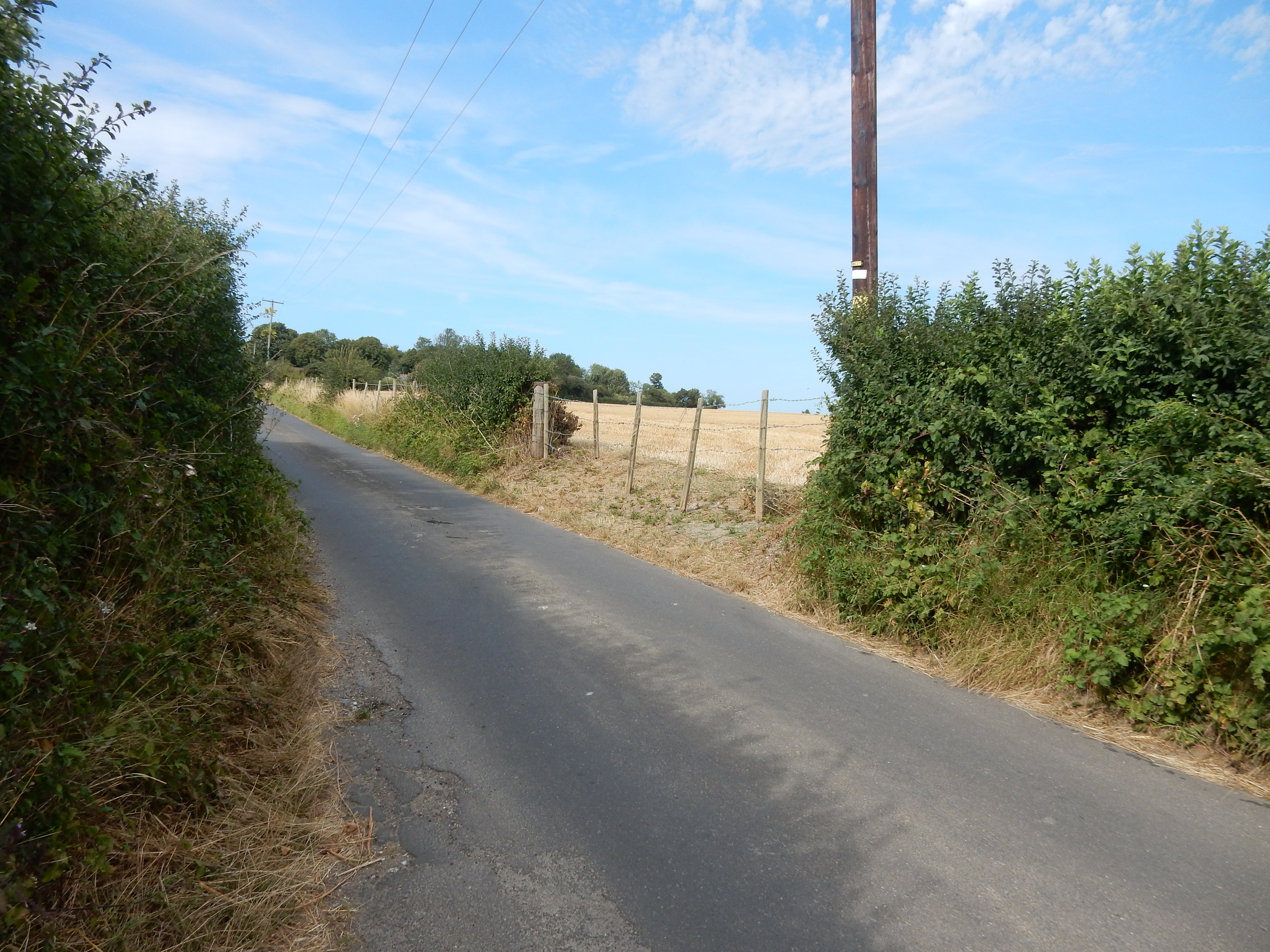
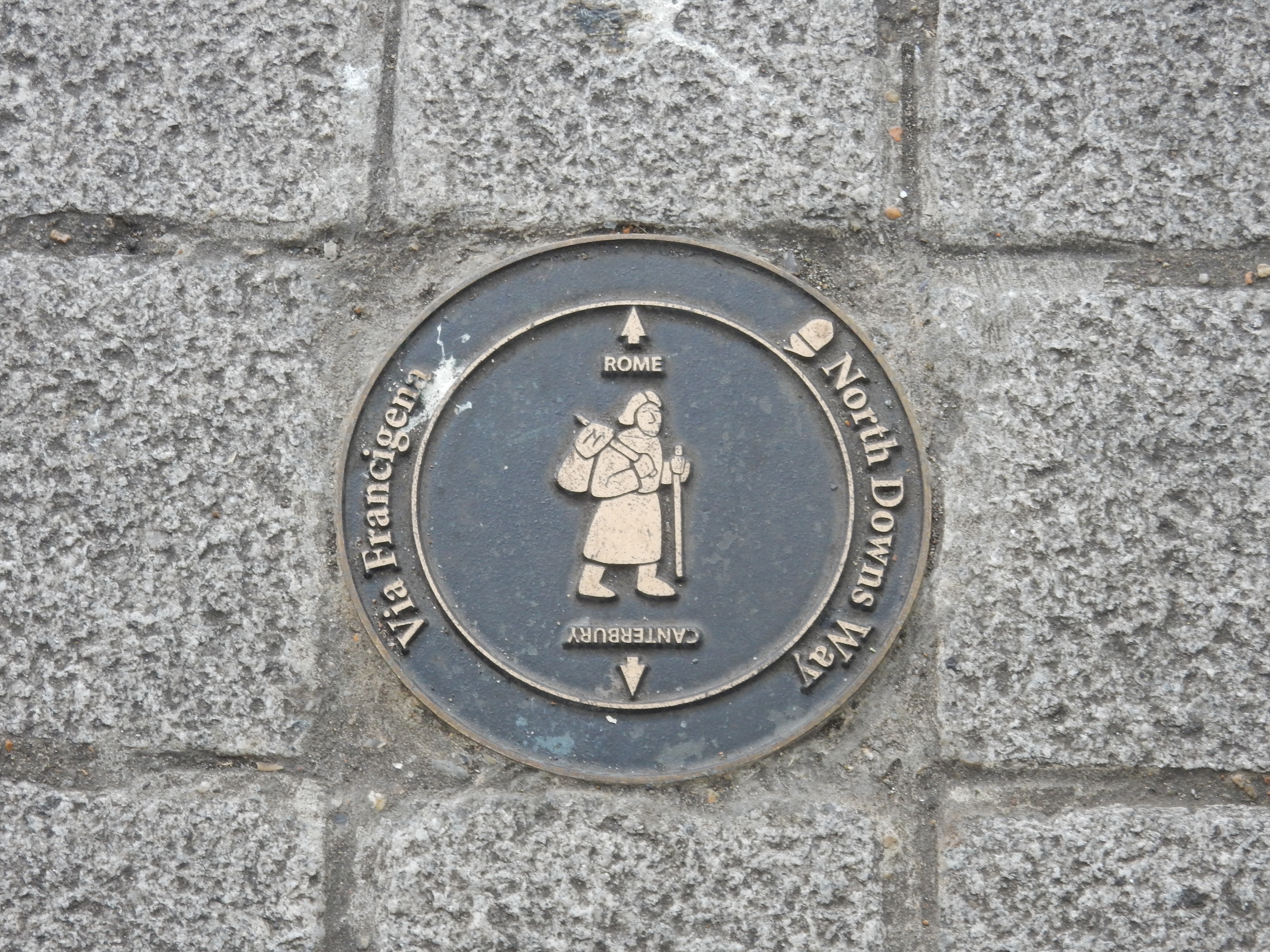
The walk starts with the usual climb upwards from the station towards the Downs and, on this section, I continue at height until the final descent towards Dover at the end. I'm now convinced that Kent has larger fields than Surrey, and this one gives an idea of the terrain I encounter through this part of England. Perhaps not the most interesting scenery the NDW has to offer, but I'll happily settle for easy navigation across rain, mud and bramble-free, flat going. As a bonus, there is enough of a breeze up here to prevent overheating. What's not to like? This section has a strangely circuitous route, swinging three miles east from Shepherdswell before turning dead south towards Dover. It makes sense because it stays on open downland rather than the valley of the River Dour (so avoiding suburban Dover until 1½ miles from the sea front). The A2 isn't so much of an earful, either. As usual for the NDW, you get the 'acorn' waymarker signage, but it is also marked as the Via Francigena well into Dover.
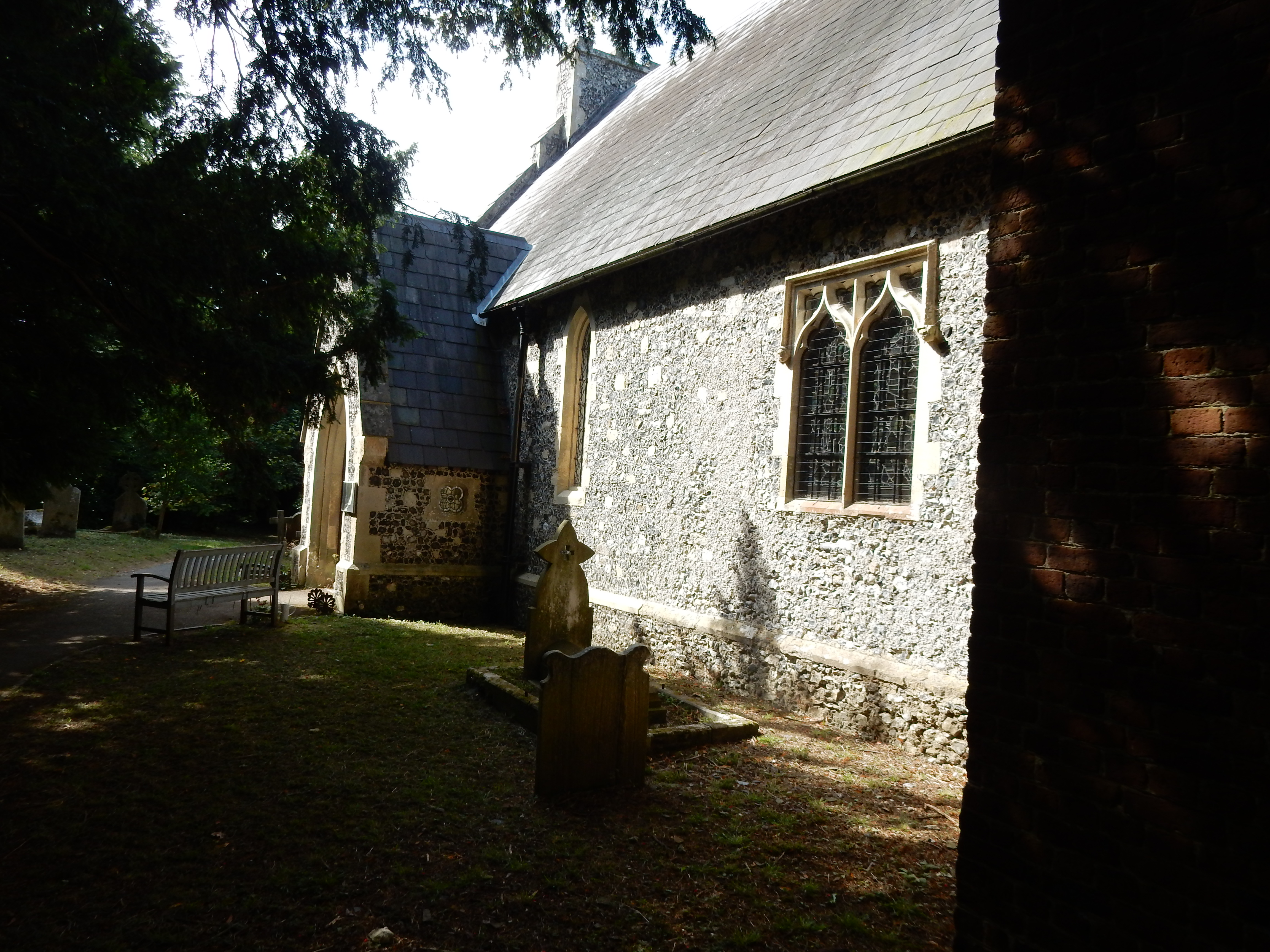
OK, where was I? Right, yes, on the way to Coldred. Here, the NDW crosses an odd, crescent shaped line of trees. Looked at on Google Earth, it suggests a disused railway line. This, in fact, is what it is, but the curvature is too tight for a conventional mainline. I then speculate that it once connected with the East Kent Light Railway that ran from Shepherdswell but, beyond Coldred, it doesn't seem to continue. It actually served to remove coal from a short lived, unsuccessful colliery. Later, during WW2, the curved track was relaid to support a railgun capable of firing long distances (although, apparently, not across the English Channel).[5] St Pancras has already been mentioned here. The church at Coldred? Saint Pancras 🤔
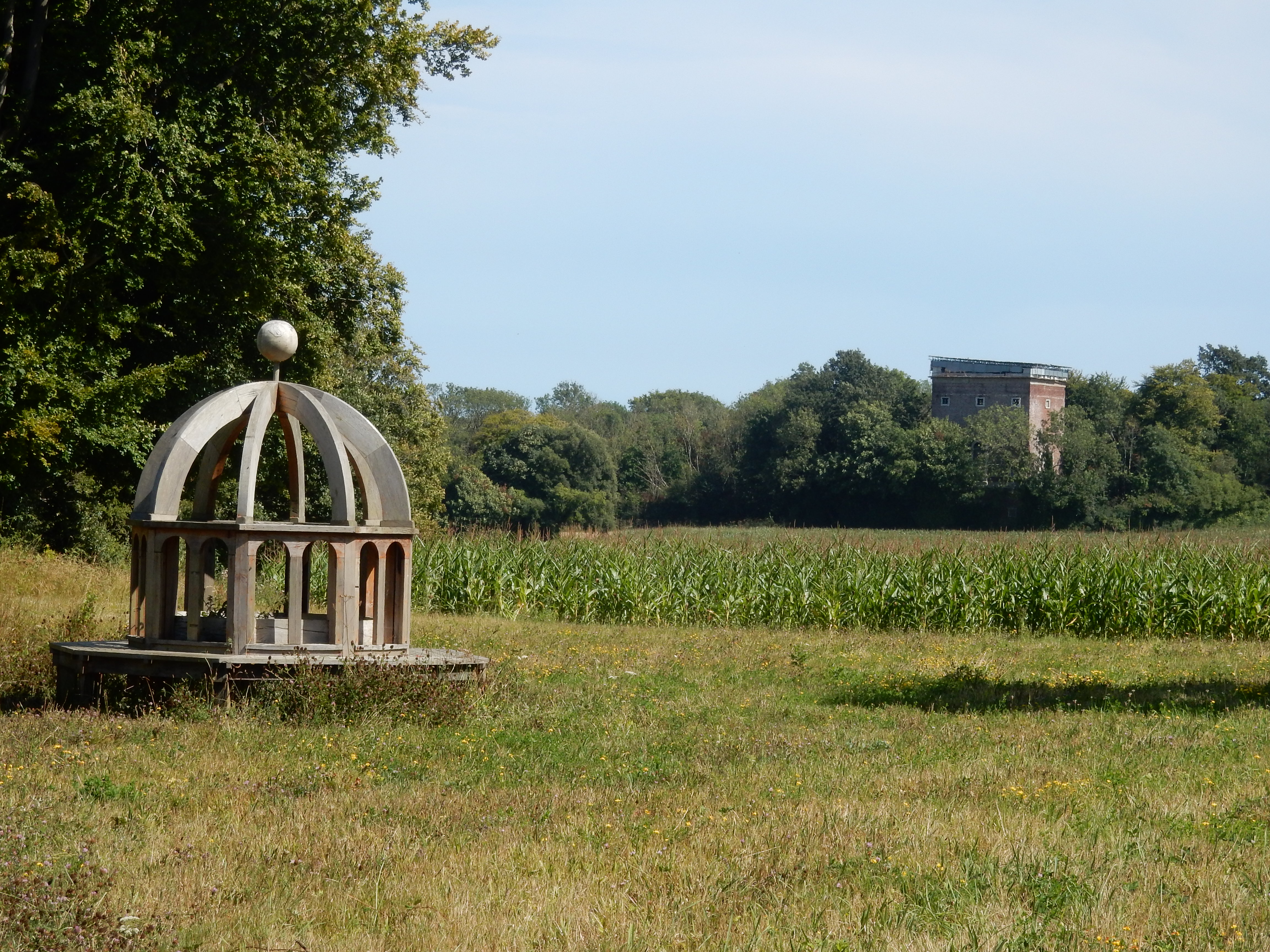
On leaving Coldred, I enter Waldershare Park. Just inside is another exhibit of The Great ARTDOORS. This, says the info board, is Monumenta Romana, and reflects what was supposed to go atop the 'belvedere' you see behind it. The main house and park are quite large, neat, Grade II listed and googleable but, so far as I am concerned, its finest feature is a seat on which I consume lunch. The NDW leaves Waldershare via All Saints Church, but the level of traffic along the main driveway is negligible deterent to that alternative. I also note another example of period ironwork there.
Wiv a ladder and some glasses
You could see to 'Ackney Marshes,
If it wasn't for the 'ouses in between.
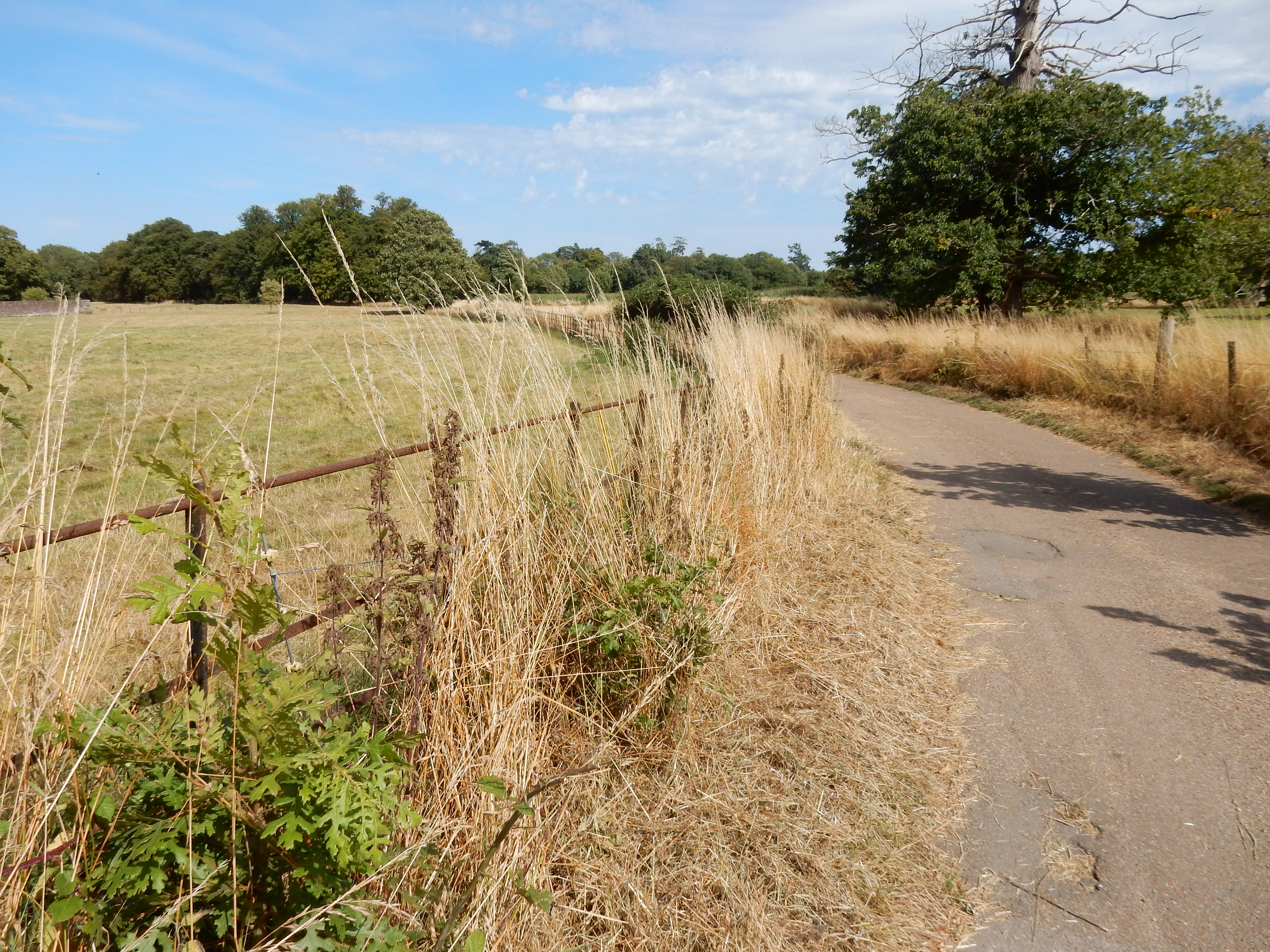
A hop over the A256 takes me into Ashley, but it is merely a walk in the road (now that its pub has gone). After Minacre Farm there is a climb up to the Roman Road south of Studdal. The route is indescernable, but just head for the top corner of the field. At the road no footway is discernable, either. Unfortunately, not so some fast traffic. Care required. Whichever planning authority was responsible for the A2 here appears also unimpressed by the efforts of its Roman predecessor. Rather than take the Via Francigena on to Dover using an underpass, my route suffers a ¾ mile diversion to the east. Must the emperor Claudius tolerate this inconvenience every time he visits B&Q? Anyway, my ill-humour (compounded by now complete cloud cover) ameliorates when I rejoin the Roman Road south of the A2, and the squawk of gulls suggests there is not far to go.[6] At 126 metres ASL this is the highest point of section 15. The descent hereafter is rapid. A month ago, I suffered much discomfort on downhill stretches, but my new boots (a size larger than the old) are giving my toes a far easier time.[7] Mid August is normally a good time to tackle downlands gradients because the chalk has dried out, and the dreaded DAB is no longer quite the worry it is during winter. This stretch of NDW is a designated byway, and has been sealed with top-notch BLA, and would be fine during a winter with little snow or ice. It would make for good cycling, but no one seems to.
Well, that was the North Downs, that was. Once over the rail line to Deal I get built-up Dover for the remainder of the NDW. It feels a little like a return to civilisation; I reached this point having passed one dog walker in the previous eight miles. Don't be confused at Old Charlton Road by the SP pointing down it; the NDW crosses the road into St. Mary's Cemetery. My only previous visit to Dover was in 1997, but I saw little besides the castle. Those who planned avoidance of suburban Dover by the NDW took no account of my interest in the architectural changes that I observe as I make my way down to the esplanade. It is a spin-off from my family history interests, and the architecture of Dover is not particularly special but, as I'm here, I may as well mention it.
The newest houses you see are those you reach first - on the edge of town. The properties around Danes Court were not built in 1960 but were there by 1972. Normally, further south, you might expect these to be followed by some 1930s houses, but Connaught Park, the cemeteries and the rail line have squeezed them out to the west. So next up, past Castle Avenue, are spacious Edwardian Villas built to a pattern seen elsewhere along the coast. Turning left into the A256[8] brings into view post-war redevelopment, probably bomb-site related. Further along are Victorian four-storey residences of a type familiar to all Londoners.
Emerging from the subway, a
war memorial
gains my attention. It references the 1857 conflict in
India that involved my gt grandfather and ill-fated pedestrian:
Richard John Clarke.[9]
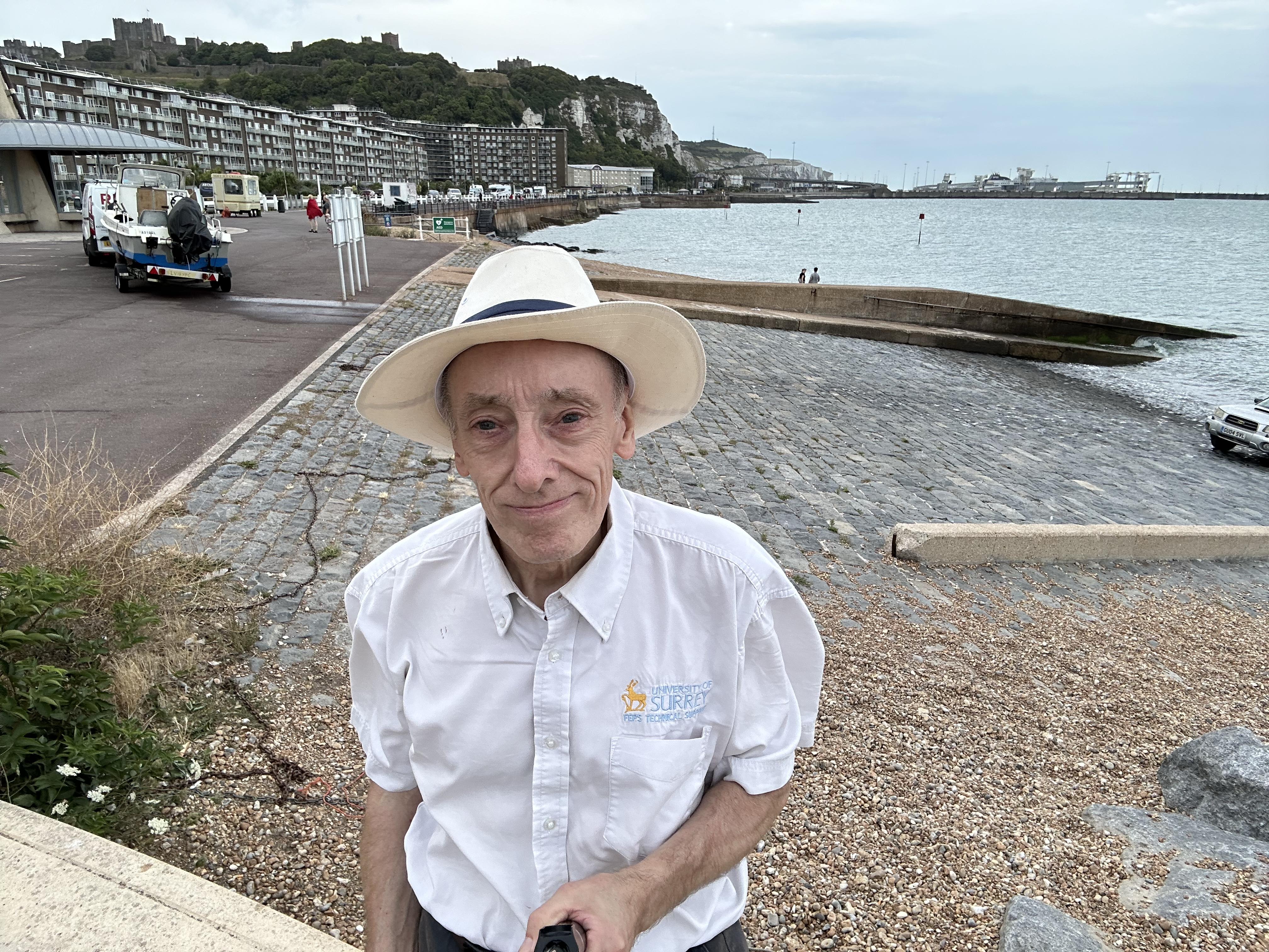
So,
here I am, journey's end:
The Promenade. It's a long, Regency terrace; a (not too) poor man's
Brighton, called Waterloo
Crescent.[10] Final thoughts on this walk of the whole North
Downs Way
...[11]
Was it worth the effort? I believe so. When I approached this
end of the NDW, train journeys became longer, more expensive and
difficult.[12] Lengthy travel also results in less time for
sightseeing expeditions.[13] Lengthy sightseeing? The USP of the North Downs
Way is that it beats the Pilgrim's Way for views. As I see it
(or rather, don't) much of the route runs between trees and high
hedges - never more noticeably than this final stretch. On the
plus side, the signage along the NDW has been good enough that I
didn't need to stare at the GPS for entire sections. All the
National Trails need only minimal planning by any user. It's a
win to take advantage of that. Although there must be more to
the NDW than I have recorded, I most likely won't ever do it all
again. There's other routes to tick off - as I've discovered
walking this one.
If you attempt a similar trek, then let me know your thoughts.